Mt. Baker Highway Road Conditions and Winter Driving
Mt. Baker road conditions for SR 542: where to check WSDOT, what a chains-required sign actually means for your car, and when the Artist Point road opens.
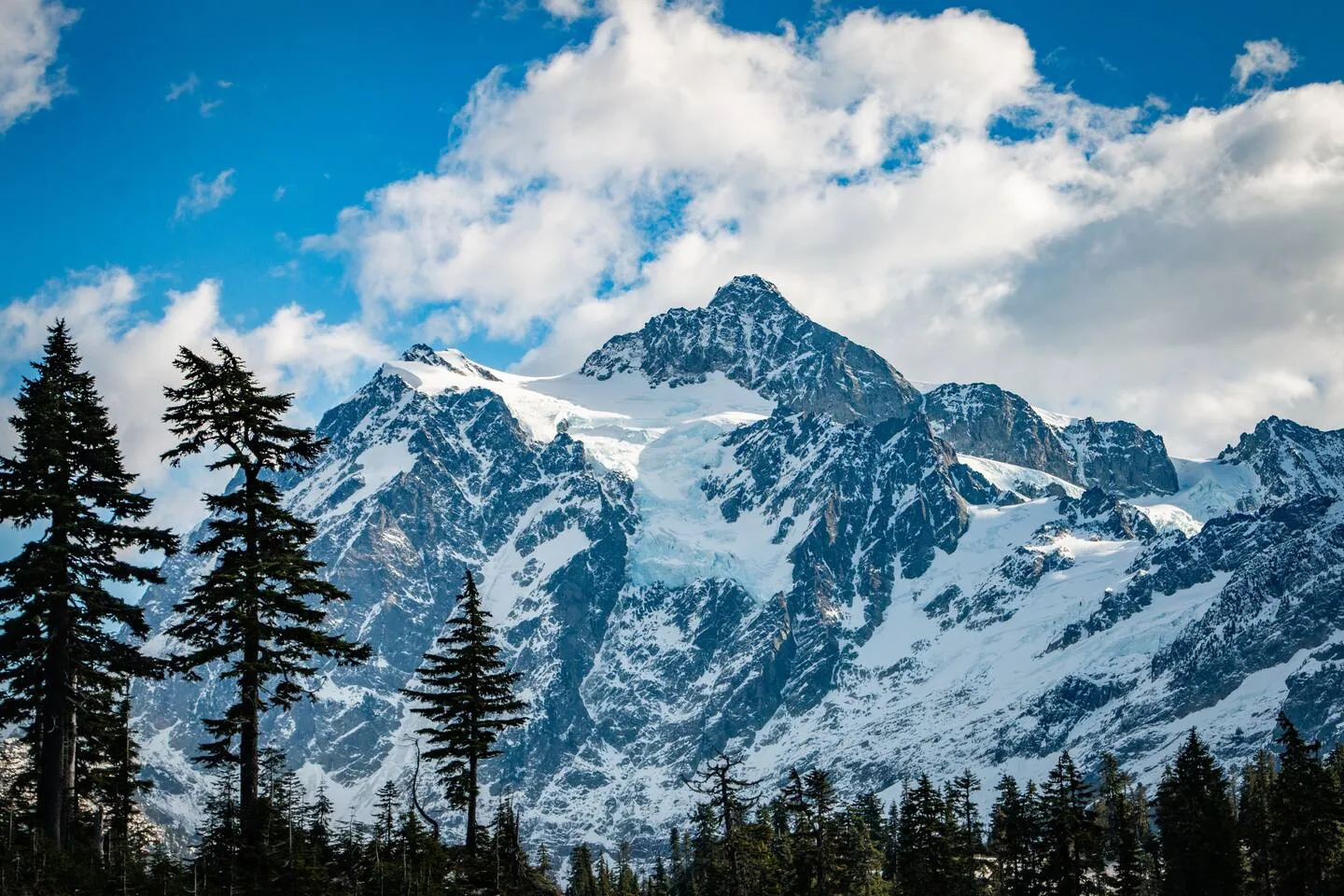
Check the WSDOT SR 542 mountain pass report first. It is the only official source for whether the Mt. Baker Highway is open and what traction restriction is posted. The highway to the ski area stays open and maintained all winter. What closes seasonally is the final 2.7 miles to Artist Point, which reopened June 10, 2026 and shuts again with the first heavy snow, usually in October.
We live at the bottom of this highway and drive it in every condition it produces. Below is the dashboard we actually use, plus the parts of Washington’s chain law that catch visitors out every single winter.
Where do I check Mt. Baker road conditions right now?
Five sources cover it. WSDOT owns road status and restrictions, NWAC owns avalanche danger, the ski area owns lift and mountain status, and the SNOTEL and webcam links tell you what the snow is actually doing. Bookmark all five; no single one answers the whole question.
| Source | What it tells you | Link |
|---|---|---|
| WSDOT SR 542 pass report | Open/closed, posted traction restriction, pass weather | wsdot.com pass report |
| WSDOT SR 542 alerts | Incidents, collisions, work closures on the highway | SR 542 alerts |
| WSDOT cameras + travel map | Statewide camera and restriction map | cameras on SR 542 · travel map |
| NWAC avalanche forecast | Danger rating for the West Slopes North zone (how to read it) | nwac.us forecast |
| NWAC Mt. Baker Ski Area station | Live mountain temp, wind, new snow, totals | station data |
| Mt. Baker Ski Area snow report | Lifts, base areas, advisories, in-season highway notes | mtbaker.us snow report |
| Glacier highway webcam | Live look at pavement and sky partway up the valley | mtbakerweathercam.com |
| Wells Creek SNOTEL (#909) | Snow depth and snow-water equivalent at 4,040 ft | NRCS site 909 |
| Whatcom County roads | County road closures below the state highway | county closures |
One thing that surprises people: Mt. Baker Ski Area does not publish its own live mountain webcams. The snow report is text — lifts, operations, advisories, snowfall numbers. The camera link above is a privately run cam mounted on the highway in Glacier, pointing east up the valley toward Church Mountain. It is genuinely useful for reading the snow line, and it is not the mountain.
Status as of October 10, 2026
- WSDOT’s SR 542 report is in its off-season posture. Daily weather and road reporting on that page traditionally runs November 1 to April 1, with updates outside that window when adverse weather warrants.
- The road to Artist Point is still open, but WSDOT has not yet posted a 2026 winter closure date. The last scheduled maintenance closures (daytime-only, prepping for winter) ran September 30 through October 6 and have already passed. Last year’s winter closure landed October 15; the historical range runs September 27 to November 1, so expect the gate to come down any day now with little notice. Mt. Baker Ski Area’s own Artist Point page is undated and shouldn’t be trusted over WSDOT’s live report.
- The September 13 Mt. Baker Hill Climb road closure has passed. The highway is back to normal access; see below for what that closure covered, for reference.
- NWAC’s daily avalanche forecasting hasn’t started for the 2026-27 season yet and no start date is posted. In recent seasons that first forecast has landed anywhere from late November to mid-December. Check nwac.us directly. Our guide to the NWAC forecast covers what the ratings mean once it’s running.
This block is a snapshot, not a live feed. Before you drive, open the WSDOT report.
Is the Mt. Baker Highway open right now?
Almost certainly yes, if you mean the stretch from Bellingham to the ski area. WSDOT maintains SR 542 to Heather Meadows through the winter, and closures below there are usually short — an avalanche control window, a slide-out, a crash. The predictable closure is seasonal and only affects the top.
Read the pass report the way locals do. The line that matters is the restriction, not the temperature. “No restrictions” means drive normally. Anything else is a legal requirement, not a suggestion, and it can change while you are on the road.
Note the reporting window. WSDOT states that weather and road conditions are traditionally reported on the SR 542 page from November 1 to April 1. Outside that stretch you may see “Reports have ended for this season,” which is not the same as “the road is fine.” Fall storms and spring slides both happen when nobody is reporting daily.
Closures are not always about weather, either. In February 2026 the ski area’s own snow report announced that SR 542 would be closed east of Glacier from Monday, February 2 through the afternoon of Friday, February 6 for contractor work, with no public access to the ski area, which closed for those days. If you are booking a midweek ski trip, glance at the ski area’s report as well as WSDOT’s.
Is SR 542 closed for any scheduled events?
Nothing scheduled right now. The one event closure this fall already happened: on Sunday, September 13, 2026 the Mt. Baker Hill Climb shut the Mt. Baker Highway to all traffic from 7 to 9 a.m. between Snowater Road and Artist Point, then from 9 a.m. to noon between Canyon Creek Road and Artist Point. We’re leaving the details below for anyone checking on a future race weekend.
| Window | Segment closed to all traffic |
|---|---|
| 7:00–9:00 a.m. | Snowater Road → Artist Point |
| 9:00 a.m.–12:00 p.m. | Canyon Creek Road → Artist Point |
The Hill Climb runs a capped field of 450 riders 22 miles from Snowater Road, just east of Chair 9 in Glacier, to the end of the highway, gaining over 4,000 feet on the way. It is a good morning to watch bike racing and a bad morning to have a trailhead reservation.
This is the surprise we head off most often in September. If you’re sleeping in Glacier or further up-valley the Saturday night before a future Hill Climb, you won’t be driving to Heather Meadows, Artist Point, or any trailhead above Snowater Road until the road reopens around midday. One forest road out of Glacier, Deadhorse Creek Road (FR 37), remains gated for flood-damage repair as of this writing, so that isn’t an alternate drive either — but Glacier Creek Road (FR 39) reopened August 20, 2026 after its own washout repairs, so Heliotrope Ridge is a normal drive-up trailhead again. Plan a slow breakfast and go up in the afternoon on race day, when the light is better anyway.
Event closures on this highway are announced well ahead of time and are easy to miss when you are booking three months out. If your dates land on a Sunday in late May or September, it is worth a look at the WSDOT SR 542 alerts page before you commit.
Do I need chains to drive to Mt. Baker?
You need to carry them. Whether you install them depends on which of four advisory levels is posted, and Washington’s wording is specific enough that guessing gets people fined. Here is what each sign actually requires, from WSDOT’s own winter driving guide.
| Posted sign | What it requires of a normal passenger car |
|---|---|
| Traction Tires Advised | Nothing mandatory for passenger vehicles. Oversize loads prohibited. |
| Traction Tires Required | All passenger vehicles must have approved traction tires. Anything over 10,000 lbs GVWR — including large trucks, SUVs and RVs — must chain up. |
| Tire Chains Required | All vehicles must install approved chains, except 4WD/AWD, which must still carry them. Violators face a $500 fine. |
| Chains Required On All Vehicles | Everyone installs chains. No exceptions, including 4WD and AWD. |
Two details that trip people up:
Studded tires do not satisfy a chain requirement. If chains are required, you install chains over the studs. Studded tires are also only legal in Washington from November 1 through March 31, and running them late is a $136 fine.
“Approved traction tires” is a specific standard, not a vibe. WSDOT requires at least an eighth of an inch of tread and a sidewall marked M+S, All Season, or the mountain/snowflake symbol. Bald all-seasons on a rental do not qualify.
Washington also approves alternative traction devices for passenger vehicles — AutoSock, Grip Tex, ISSE Safety, Polaire Grip, Polaire Steel and SOS Grip, plus Easy Grip EVO for front-wheel drive only. They are far easier to fit in a parking lot in the dark than steel chains. Buy them before the trip and practice once in your driveway, because the first time you install anything should not be on a shoulder at 4,000 feet with a line of cars behind you.
Does AWD or 4WD exempt me from chains?
Not the way most drivers assume. At the “Tire Chains Required” level, four- and all-wheel-drive vehicles are exempt from installing chains — but WAC 204-24-050 grants that exemption only when all wheels are in gear, the vehicle is on approved traction devices, and chains for at least one set of drive tires are in the vehicle. WSDOT puts it plainly: 4WD and AWD must still carry chains during that advisory level or face a violation and a fine.
And when the sign reads “Chains Required On All Vehicles,” the exemption disappears entirely. That is the level WSDOT posts in genuinely bad weather, and an empty trunk means you turn around.
The practical version we give guests: all-wheel drive helps you go. It does very little to help you stop. The corridor above Glacier is a steep, curving, heavily forested climb, and the drivers who end up in the ditch are rarely the ones in two-wheel drive with good tires.
Where does the chain requirement zone start on SR 542?
WSDOT’s route listing puts the SR 542 chain-requirement zone between milepost 22.91 and milepost 57.26 — from Kendall, near the SR 547 junction, all the way to the end of the highway at Artist Point. That listing is written for vehicles over 10,000 pounds, which must carry chains on that stretch at all times from November 1 to April 1 regardless of conditions.
For everyone else, the number to know is that the zone starts far lower than people expect. You are inside it before you reach Maple Falls. What actually gets posted on a given day may cover a shorter upper segment, so read the sign at the point where the restriction begins and check the WSDOT report before you commit to the drive.
When does the road to Artist Point open?
Early-to-mid summer, and later than almost anyone guesses. The final 2.7 miles of SR 542 above the ski area is narrow, steep and avalanche-prone, so WSDOT gates it every fall and digs it out every spring.
In 2026 it reopened Wednesday, June 10 at 7 a.m. after crews removed as much as 20 feet of snow from the highway and the Artist Point parking lot, working since late May. In 2025 it closed on October 15. The ski area describes the segment as typically buried and closed October through June, sitting just over 5,000 feet.
Two things to plan around. First, opening day does not mean hiking season: WSDOT specifically warns that many trails accessed from Artist Point remain under deep snow when the road opens. Second, parking there requires a Northwest Forest Pass — $5 per day or $30 annual — and there is a vault toilet but no potable water.
What are the gates and landmarks on the highway?
| Milepost | What is there |
|---|---|
| ~22.9 | Kendall. Chain-requirement zone begins. Cell service starts failing. |
| ~24.6 | Maple Falls. Last gas on the highway. Groceries, permits, coffee. |
| ~33 | Glacier. Last food and lodging cluster. No fuel. |
| 46 | Salmon Ridge Sno-Park. Snowshoe and nordic trails, 2,000 ft. |
| 52 | White Salmon Base Area, Mt. Baker Ski Area. |
| 55 | Heather Meadows Base Area. Upper lots, and the sledding bowl just outside the ski area boundary. |
| 54.5–57.2 | Artist Point road. Gated in fall, cleared each spring. |
Mileposts for Maple Falls and Glacier are approximate; the ski area base areas are where the ski area places them, at 52 and 55 miles from Bellingham.
If you are stopping at Salmon Ridge, that lot needs a Washington Sno-Park permit from December 1 to March 31 — $25 daily or $50 seasonal, plus a $3 handling fee at retail vendors. Ignore the $70 Special Groomed Trail permit: State Parks requires it at eight named Sno-Parks — Cabin Creek, Lake Easton, Chiwawa, Lake Wenatchee, Crystal Springs, Mount Spokane, Hyak and Nason Ridge — and Salmon Ridge is not one of them. The Sno-Park itself has roughly 40 spaces and about 15 miles of non-motorized trail, and it fills on bluebird weekends.
What we tell guests before a powder day
Leave early, and mean it. The ski area says to arrive around 8 a.m. when the lots open, and that Saturday, Sunday and holiday traffic runs heaviest from about 8:30 to 11:30 a.m. The other good window is after noon, with discounted afternoon tickets from 12:30. Mid-morning on a storm Saturday is the worst possible plan.
Fuel in Maple Falls. There is no gas in Glacier and none at the mountain. WSDOT’s own winter checklist starts with a full tank, and the reason is closures: if the highway shuts for avalanche control, you idle where you are.
Download everything before Kendall. Coverage collapses around there, with unreliable pockets in Glacier and near the base areas and nothing at Artist Point. Offline maps, your lift ticket, your check-in instructions, this page.
Carry more than chains. Boots you can stand in on a shoulder, gloves, a headlamp, water, snacks, a charged phone. The gap between an inconvenience and a genuinely bad night on this highway is usually a pair of dry gloves.
Remember the last mile is not WSDOT’s. The state maintains SR 542. Whatcom County maintains 960 miles of county road below it and warns that lower-priority roads may go up to two weeks without snow removal in extreme conditions. Cabin driveways and subdivision lanes are plowed by owners, not the county. Ask your host what their plan is — ours is that we clear both properties and tell you honestly if we think your car will make it.
Where to stay so the drive is short
There is no lodging at Mt. Baker Ski Area. None — no hotel, no village, no slopeside anything. Everyone sleeps down the highway, which makes where you book a road-conditions decision as much as a comfort one.
Our black A-frame sits on the Glacier side of the valley, about 40 minutes from the ski area and 15 minutes from the last gas in Maple Falls. It is the shorter morning drive on a powder day, and it has a cedar barrel sauna, a hot tub and an espresso bar for the days the highway wins. Our red cabin is in Maple Falls, about 45 minutes from the lifts and a few minutes from the fuel pump, with a private hot tub of its own. Both are strictly no-pet, both sleep small groups well, and between them they hold 350 five-star reviews.
If you are still deciding, our Mt. Baker lodging guide compares the whole corridor, where to stay near Mt. Baker breaks it down town by town, and if the hot tub is the point, start with cabins with a hot tub or the A-frame. For the mountain itself, our Mt. Baker Ski Area guide covers snowfall, terrain and storm days, cabins near Mt. Baker compares the towns, and the best hikes near Mt. Baker is what you want once the Artist Point gate is open.
How this page stays accurate
Everything above was verified against a live source on the date shown at the top. The status block is re-checked through the winter, and any number here that comes from WSDOT, NWAC, the Forest Service or Washington State Parks is linked so you can confirm it yourself in one click.
What we will never do is tell you the road is clear. Conditions on SR 542 change in an hour. Use the dashboard, read the sign in front of you, and carry the chains.
Common questions
- Do I need chains to drive to Mt. Baker?
- You need to carry them. Washington requires chains in the vehicle inside posted zones on SR 542 all winter, and whether you install them depends on the advisory level posted that day. Check the WSDOT SR 542 pass report before you leave, and buy chains that fit your tires before the trip.
- Does all-wheel drive exempt me from chain requirements?
- Only at the "Tire Chains Required" level, and only if you are carrying chains. WSDOT states that 4WD and AWD vehicles must still carry chains at that level or face a fine. When signs read "Chains Required On All Vehicles," every vehicle installs chains, including AWD and 4WD.
- Is the Mt. Baker Highway open right now?
- The lower highway to the ski area is maintained and open year round, and closures are usually short and weather-driven. The seasonal closure is the final 2.7 miles to Artist Point. Check the WSDOT SR 542 mountain pass report for the current restriction rather than trusting any static page.
- When does the road to Artist Point open?
- Early-to-mid summer, once crews clear the snow off the final 2.7 miles. In 2026 it reopened Wednesday, June 10 after WSDOT removed as much as 20 feet of snow from the highway and the Artist Point lot. It closes again with the first heavy snowfall, usually in October.
- Where do I check Mt. Baker road conditions?
- WSDOT SR 542 mountain pass report for restrictions and closures, NWAC for avalanche danger, and the Mt. Baker Ski Area snow report for lift and mountain status. WSDOT reports daily on that page from November 1 to April 1 and posts updates outside that window when weather warrants.
- Is there gas in Glacier, WA?
- No. Glacier has food, coffee and a small store, but no fuel. The last gas on the Mt. Baker Highway is in Maple Falls, roughly 15 minutes below Glacier, and there is none at the ski area. Fill up on the way in, not on the way out.
- Does cell service work on the Mt. Baker Highway?
- Barely. Coverage falls apart around Kendall, with unreliable pockets in Glacier and near the ski area, and nothing at Artist Point. Download maps, lift tickets and this page before you leave town or before you leave the cabin WiFi.
- Do I need a pass to park along the Mt. Baker Highway?
- It depends where you stop. Artist Point and most Forest Service trailheads need a Northwest Forest Pass ($5 day, $30 annual). Salmon Ridge Sno-Park at mile 46 needs a Washington Sno-Park permit from December 1 to March 31. Ski area lots need neither for day visits.
Get “The Perfect Mt. Baker Weekend” — free
The locals’ guide from your hosts on the highway: the hikes worth the drive, where locals actually eat, 3 copy-paste weekends, and 10% off a stay at our cabins.