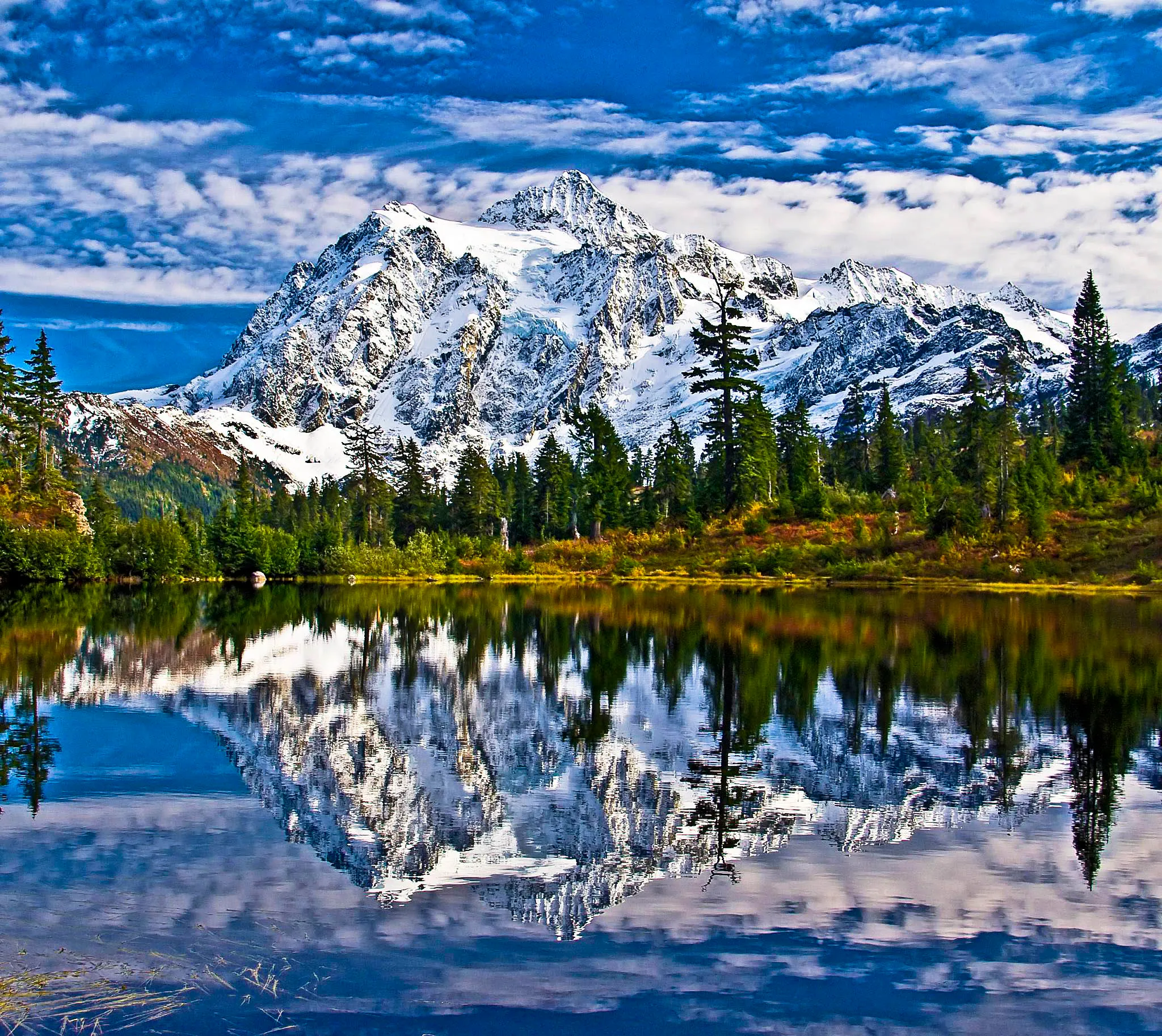
The best hikes near Mt. Baker sort into three tiers: short roadside walks at Heather Meadows and Artist Point, half-day alpine loops off the end of the highway, and forest-road approaches that ask more of you and your car. One of those forest roads is closed to vehicles as of today; the other reopened in late August. Everything reached from the paved highway is open.
We live on this highway and hike it year-round. Every number below comes from the Washington Trails Association trail listing for that hike, and every road status from the Mt. Baker-Snoqualmie National Forest alerts page. Conditions here change fast — re-check both before you drive up.
Which hikes near Mt. Baker are open right now?
Everything you can reach from SR 542 itself, plus Heliotrope Ridge now that its access road is back. Only one closure remains, on a Forest Service road out of Glacier: Skyline Divide (Deadhorse Creek Road / FR 37, gated at mile 0.03 since June 1, 2026 for flood-damage repair — the trail itself is still legally hikeable, you just have to earn the trailhead on foot or bike). Heliotrope Ridge’s own access road, Glacier Creek Road (FR 39), was closed at milepost 3.0 from a December 2025 flood washout but reopened to vehicles on August 20, 2026 after repairs — you can drive to the trailhead again. One side road off FR 39, Grouse Butte Road (FR 36), stays closed to motorized use at mile 0.6.
| # | Hike | Round trip | Elevation gain | High point | Trailhead access |
|---|---|---|---|---|---|
| 1 | Picture Lake | 0.6 mi | 45 ft | 4,157 ft | Paved, Heather Meadows |
| 2 | Bagley Lakes | 2.0 mi | 150 ft | 4,300 ft | Paved, Heather Meadows |
| 3 | Horseshoe Bend | 2.4 mi | 220 ft | 1,200 ft | Paved, SR 542 near Douglas Fir |
| 4 | Artist Ridge – Huntoon Point | 1.2 mi | 200 ft | 5,150 ft | Paved, Artist Point |
| 5 | Table Mountain | 2.6 mi | 725 ft | 5,700 ft | Paved, Artist Point |
| 6 | Chain Lakes Loop | 6.5 mi | 1,820 ft | 5,400 ft | Paved, Artist Point |
| 7 | Ptarmigan Ridge | 9.0 mi | 1,800 ft | 6,100 ft | Paved, Artist Point |
| 8 | Yellow Aster Butte | 7.5 mi | 2,550 ft | 6,150 ft | Twin Lakes Rd (FR 3065), 4.5 mi gravel |
| 9 | Skyline Divide | 9.0 mi | 2,500 ft | 6,563 ft | FR 37 closed to vehicles |
Heliotrope Ridge (5.5 mi, 1,400 ft gain, 5,100 ft) is the tenth one everyone asks about. Its access road was the other casualty of the December 2025 flooding, but it reopened to vehicles August 20, 2026, so the drive-to-trailhead version is back on.
What are the easiest hikes near Mt. Baker?
Picture Lake, Bagley Lakes, and Horseshoe Bend. Picture Lake is a 0.6-mile paved loop with 45 feet of gain — the Mt. Shuksan reflection shot, and genuinely stroller-friendly. Bagley Lakes adds a 2-mile basin walk below the ski area. Horseshoe Bend is 2.4 miles along the North Fork Nooksack at 1,200 feet, low enough to be passable all year.
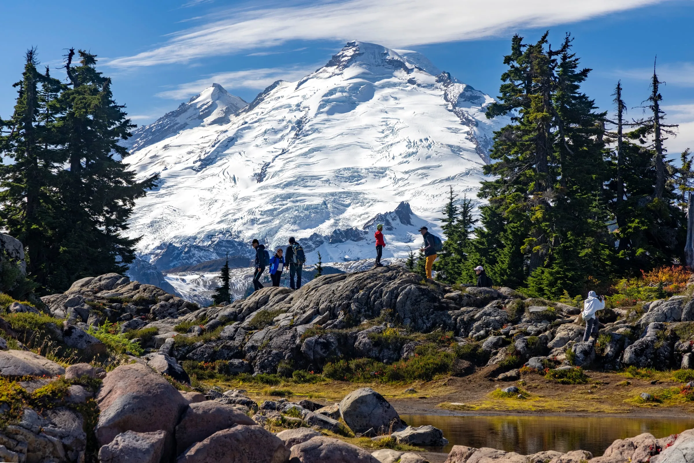
Horseshoe Bend is the one we send guests to in April and November, when the upper mountain is still buried and everything above Glacier is a snowfield. It’s mossy, loud with river noise, and canopied enough that rain barely reaches you.
Nooksack Falls deserves a mention here even though it’s barely a hike: 0.1 miles, 14 feet of gain, no pass required, and a fenced viewing platform over a genuinely large waterfall. Note that WTA flags the road past the falls toward Cougar Divide as closed at the North Fork bridge due to an eroded roadway.
What is the single best day hike at Mt. Baker?
The Chain Lakes Loop — 6.5 miles, 1,820 feet of gain, topping out at 5,400 feet. It strings Iceberg, Hayes, and the Mazama Lakes together under Table Mountain, with Mt. Baker on one side and Mt. Shuksan on the other for most of it. You can start it from Artist Point, from Austin Pass at Heather Meadows, or from the Bagley Lakes trailhead.
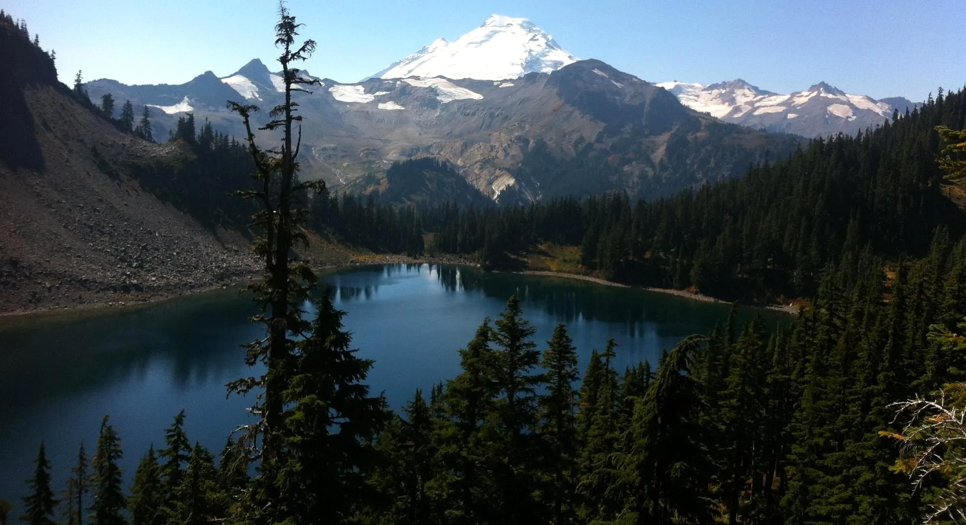 Iceberg Lake on the Chain Lakes Loop. Photo: Dan Ust, CC BY-SA 4.0, via Wikimedia Commons.
Start at Artist Point and hike it clockwise if you want the climbing done early. Start from Heather Meadows and you pay 700 feet over 0.8 miles just to reach Artist Point, which is a rough way to begin a day.
Which short hike has the best views for the effort?
Artist Ridge — 1.2 miles round trip, 200 feet of gain, and a 5,150-foot high point reached straight from the parking lot. WTA is blunt that it is accessible for less than three months a year, and that the Artist Point lot can still hold snow in late summer.
If you want more, Table Mountain is 2.6 miles and 725 feet from the same lot. It is short, and it is not casual: WTA warns the route can be treacherous with snow, ice, or loose gravel, has real exposure and drop-offs, is not recommended for small children, and does not allow dogs. Both of our cabins have a strict no-pets policy anyway, so that last one rarely comes up for our guests.
What are the big-day hikes near Mt. Baker?
Four of them, and one currently starts with a road walk. Ptarmigan Ridge is 9 miles and 1,800 feet from Artist Point, holding snow on talus late into the year. Yellow Aster Butte is 7.5 miles and 2,550 feet off Twin Lakes Road. Skyline Divide is 9 miles and 2,500 feet to a 6,563-foot ridge. Heliotrope Ridge is 5.5 miles and 1,400 feet to the Coleman Glacier, and its access road is drivable again as of late August.
A few things worth knowing before you commit to any of these:
- Yellow Aster Butte crosses an avalanche path and is not a snow-season hike. The Forest Service requires you to pack out human waste on this trail — not bury it — and to camp at or beyond the tarns, four miles in. Our full Yellow Aster Butte guide covers the gravel road, the roadside-only parking and the current pass prices.
- Skyline Divide is reached via Deadhorse Creek Road, which normally means 12.9 miles of switchbacks, potholes, and blind turns before you even park. With FR 37 gated at mile 0.03, that whole approach is currently a walk or a bike ride.
- Heliotrope Ridge’s hazard is Heliotrope Creek, and WTA does not soften it: real injuries have happened there. The crossing runs higher and faster in the afternoon on warm days. Go early, bring poles, and bring shoes you don’t mind soaking. Glacier Creek Road back to the trailhead reopened August 20, 2026 after flood repairs, so you no longer need to add the road-walk miles.
- Ptarmigan Ridge is the one people underestimate because it starts flat. It doesn’t stay flat, and it’s exposed the whole way.
When do the high trails at Mt. Baker melt out?
Late. The last 2.7 miles of SR 542 to Artist Point are closed by snow most of the year — WSDOT crews cleared as much as 20 feet of it before reopening the road at 7 a.m. on June 10, 2026. In 2025 it opened June 27 and closed October 15. Trails above 5,000 feet can hold snow for weeks after the road opens.
That gives you a practical calendar:
| Window | What’s realistically open |
|---|---|
| Nov–Apr | Horseshoe Bend, Nooksack Falls, valley trails; Heather Meadows becomes a snowshoe zone |
| May–early Jun | Valley trails; upper highway still gated |
| Mid-Jun–Jul | Artist Point road open, high trails patchy with snow |
| Aug–Sep | Everything; peak wildflowers early August, best overall conditions |
| Oct | Huckleberry and heather color at Yellow Aster Butte until the first heavy snow |
One correction we make constantly: there are no larches at Heather Meadows or Artist Point, whatever Pinterest suggests — and none at Yellow Aster Butte either, since Washington’s larches grow east of the Cascade crest. What Yellow Aster has is huckleberry and heather color across open slopes; for real larch stands you’re driving Highway 20. We go deeper on the season in our Mt. Baker fall color guide and the complete Artist Point guide.
Do you need a pass to park at Mt. Baker trailheads?
Yes, at nearly all of them. WTA lists an America the Beautiful Pass or Northwest Forest Pass as required for every numbered hike here except Nooksack Falls. The Northwest Forest Pass runs $5 for a day pass and $30 annually, sold through recreation.gov and the Forest Service. Buy it before you leave.
That last part matters more than it sounds. Cell service dies around Kendall with only pockets in Glacier, so you cannot reliably buy a digital pass at the trailhead. Download your maps, your pass, and your directions while you still have bars.
Can you have a campfire at Mt. Baker right now?
Yes, as of September 15, 2026. The Stage 1 fire restrictions that took effect forest-wide on July 23 were originally written to run through October 31, but the Mt. Baker-Snoqualmie rescinded them effective September 15, 2026, six weeks early. Fire danger in the Cascades North rating area is back down to Moderate. Campfires, charcoal and propane fire pits are all legal on forest land again, in established rings where the site allows them. Artist Point is the exception — no fires there in any year. Check the Forest Service alerts page anyway before you plan a cooked meal outside; a dry spell can put the order straight back.
This is also why a gas fire pit at a cabin is worth more than it sounds in August — it isn’t subject to the same problem as a wood fire in the woods.
Where should you stay to hike Mt. Baker?
Down the valley, because there is no lodging at the mountain — the ski area says so on its own accommodations page. Every hike on this list is a day trip from Glacier or Maple Falls, and the difference between the two towns is about 15 minutes of morning driving.
Our A-frame sits on a forested lot near Glacier, roughly 10 minutes from town and closest to the Skyline Divide and Heliotrope Ridge approaches. Secret river trails leave the property through the woods to the North Fork Nooksack, which is a useful thing on a day when you don’t want to drive anywhere. It sleeps 6 across three bedrooms and has a cedar barrel sauna, a hot tub, and an outdoor shower — the correct order to use them in after Chain Lakes is sauna, cold rinse, tub.
Our red cabin is 15 minutes further west in Maple Falls, sleeps 4, and has its own private hot tub and a trail up Red Mountain from the door. It’s about an hour to Artist Point, and Maple Falls is where the last gas on the highway is, so you pass the pump on the way up anyway.
Both are covered in our cabins with a hot tub guide, and if you’re still deciding which end of the valley to book, where to stay near Mt. Baker lays out the tradeoffs. Before any drive up, check our road conditions page and the mile-by-mile highway guide.
Sources: WTA hike listings · Mt. Baker-Snoqualmie National Forest alerts · WSDOT: Road to Artist Point reopens June 10, 2026 · Cascadia Daily News: Glacier Creek Road reopens, Aug 20, 2026 · Northwest Forest Pass, USFS Pacific Northwest Region · Mt. Baker Ski Area accommodations