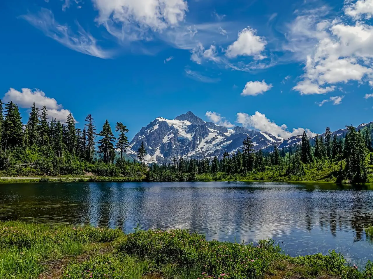
The Mt. Baker Highway (SR 542) runs 57.24 miles from I-5 exit 255 in Bellingham to Artist Point, and it dead-ends there. There is no through route to the east side of the Cascades. The bottom 54 miles are open year-round; the final 2.7 miles above the ski area open in early summer and close with the first heavy snow.
We drive this road several times a week. Here is what is actually at each milepost, what is open right now, and what to do about the last 24 miles having no services at all.
How long does the drive from Bellingham to Artist Point take?
About an hour and 45 minutes each way with no stops. Nobody does it with no stops. Plan on a half day if you want Nooksack Falls, Picture Lake, and time to stand at the top. Mileposts on SR 542 count up from I-5, so a milepost number is also roughly your mileage from Bellingham.
| Segment | Drive time |
|---|---|
| Bellingham (I-5 exit 255) to Maple Falls | 35 min |
| Maple Falls to Glacier (MP 33) | 15 min |
| Glacier to Mt. Baker Ski Area (MP ~54.5) | 35–40 min |
| Ski area to Artist Point (MP 57.26, summer only) | 10–15 min |
Those times are ours, from driving it constantly in every season. Add a good 20 minutes on a powder Saturday and more if you get behind an RV above Glacier.
What is at each milepost on the Mt. Baker Highway?
The road climbs from sea level in Bellingham to 5,140 feet at Artist Point. Farmland to about milepost 23, foothill towns to 33, then national forest the rest of the way. Every service on the highway is below milepost 33.
| MP | Stop | What is there | Season |
|---|---|---|---|
| 0 | Bellingham, I-5 exit 255 | Last full-service city. Fuel, groceries, gear shops, hospital | Year-round |
| 10.0 | Nugents Corner (SR 9 north) | Roundabout where SR 9 splits north | Year-round |
| 14.6 | Deming (SR 9 south) | Valley crossroads. The Nooksack starts running beside you, and Deming Homestead Eagle Park is just east of the junction | Year-round |
| 22.9 | Kendall (SR 547) | Cell service starts getting unreliable east of here | Year-round |
| 26.6 | Maple Falls | Last gas on the highway. Grocery, ATM, two Sno-Park permit vendors. Mt. Baker Visitor Center at 7509 Mt. Baker Hwy | Year-round |
| 33 | Glacier | Last food and coffee. No gas station. National forest begins | Year-round |
| 34 | Glacier Public Service Center | Forest Service desk, maps, passes, 24/7 self-serve day-pass kiosk. Daily 8 a.m.–4:30 p.m. | Year-round |
| ~34.8 | Glacier Creek Rd (FR 39) | Road to Heliotrope Ridge and Mt. Baker’s climbing routes | Closed at MP 3.0 (see below) |
| 35 | Douglas Fir Campground + Horseshoe Bend trailhead | 26 sites on the river; Horseshoe Bend is 2.4 mi round trip, 220 ft, low enough to walk all year | Campground late May–Sept |
| ~39.4 | Church Mountain (FR 3040) | 2.7 mi of forest road to an 8.5-mile, 3,750-ft climb | Summer–fall |
| 40.5 | Nooksack Falls (Wells Creek Rd / FR 33) | Turn 0.6 mi east of MP 40, then two-thirds of a mile of gravel to an 88-foot double plunge. Stay behind the fences | Year-round |
| 46 | Silver Fir Campground | Riverside sites, tents and RVs, group shelter | May–Sept |
| 46 | Salmon Ridge Sno-Park | 40 parking spaces, 15 miles of non-motorized trails, groomed Dec 1–Mar 31 | Winter |
| ~46 | Twin Lakes Rd (FR 3065) | At the east end of the WSDOT Shuksan maintenance yard. 4.5 rough miles to Yellow Aster Butte | Summer–fall |
| ~54.5 | Mt. Baker Ski Area, Picture Lake, Heather Meadows | Lodges, the Picture Lake loop, Bagley Lakes and Chain Lakes trails. Winter road ends here | Year-round to here |
| 54.55–57.26 | Road to Artist Point | 2.7 narrow miles, sharp curves, steep drop-offs | Early summer to first snow |
| 57.26 | Artist Point, 5,140 ft | End of the road. Vault toilets, garbage cans, Northwest Forest Pass required to park | Summer–fall |
Where is the last gas, food, and cell service?
Maple Falls has the last gas station on SR 542. Glacier has food and coffee but no fuel, and above Glacier there are 24 miles of national forest with no gas, no store, and no reliable cell signal. Fill up in Maple Falls, download your maps and lift tickets, and treat Glacier as your last real stop.
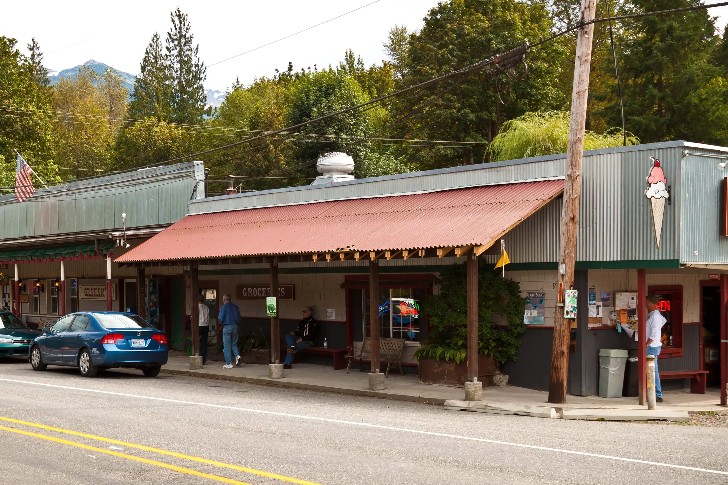 Glacier’s main drag. Photo: ravas51, CC BY-SA 2.0, via Wikimedia Commons. Edited.
We wrote the full version of this in there is no gas in Glacier, because it is the single thing guests are most surprised by. The Forest Service desk at milepost 34 is the best place on the highway to ask a human about road and trail conditions, and its kiosk sells day passes when the office is closed.
Which stops are actually worth pulling over for?
Four, in the order you hit them. Nooksack Falls at MP 40.5 is a five-minute walk from the car and the best effort-to-payoff stop on the road. Horseshoe Bend at MP 35 is a flat river trail that works in January. Picture Lake near MP 54.5 is a ten-minute loop. Artist Point is where you spend the rest of the afternoon.
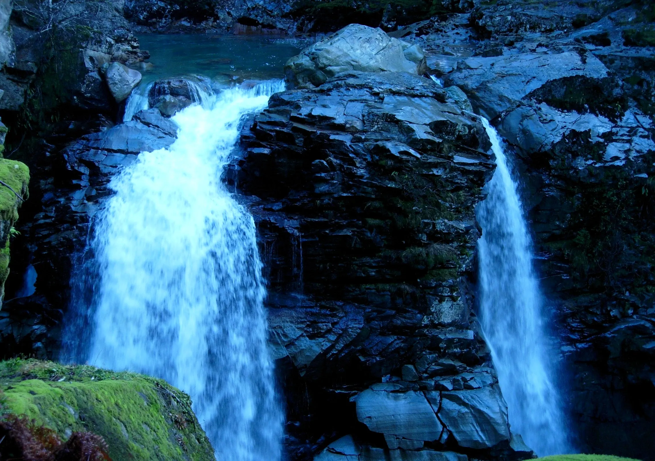
Nooksack Falls has a real safety history. People have died going past the fences to get a better photo, on wet rock above an 88-foot drop. The fence is where the view stops.
For the longer days out from these trailheads, our best hikes near Mt. Baker guide sorts them by effort, and the complete Artist Point guide covers the walks from the top parking lot.
What is closed on the Mt. Baker Highway right now?
As of August 29, 2026, the highway is open its full length, including the road to Artist Point, which reopened at 7 a.m. on June 10 after crews cleared up to 20 feet of snow. One of the best side roads off it is still closed, the summer campfire ban has been lifted, and one Sunday in September the highway itself shuts for a bike race.
- Glacier Creek Road (FR 39), closed to vehicles at the Glacier Creek bridge (MP 3.0) since a December 2025 flood washout, reopened August 20, 2026 after repairs. The Heliotrope Ridge trailhead is drivable again. A side spur off it, Grouse Butte Road (FR 36), stays closed to motorized use at mile 0.6.
- Deadhorse Creek Road (FR 37) is still closed at MP 0.03 until further notice for flood damage repair, which closes the drive to Skyline Divide.
- Stage 1 fire restrictions took effect July 23, 2026 forest-wide, including campgrounds and wilderness, and were written to run through October 31 — but the forest rescinded them effective September 15, 2026. Campfires, charcoal and propane fire pits are legal on forest land again. Fire danger for the Cascades North rating area is back to Moderate. Re-checked September 26, 2026.
- Sunday, September 13, 2026: SR 542 closes to all traffic for the Mt. Baker Hill Climb — 7 to 9 a.m. from Snowater Road to Artist Point, then 9 a.m. to noon from Canyon Creek Road to Artist Point. Nothing above Snowater Road is drivable that morning, and with FR 37 still gated there is no side road to fall back on either. Go up after lunch.
Forest road closures here change without much notice. Check the Mt. Baker-Snoqualmie alerts page the morning you go, not the week before. Our Artist Point road status page tracks the top 2.7 miles year by year, and our road conditions guide carries the full version of the September closure alongside the winter chain rules.
What changes on this drive in winter?
The gate above the ski area closes with the first heavy snow, usually in October, and the highway effectively ends around milepost 54.5 until June. Chains are the law in posted zones on SR 542 regardless of what you drive, and conditions on the upper road can change inside an hour.
Check the WSDOT Mt. Baker Highway pass report before you leave, not when you are already past Glacier with no signal. We keep a plain-English version on our road conditions page, and the details of what a chains-required sign means for your specific car are in chains and winter driving on SR 542.
One winter fact that catches people every year: there is no lodging at Mt. Baker Ski Area. None. The nearest beds are down the highway in Glacier and Maple Falls, which is also covered in our ski area guide.
Which pass do you need to park along the way?
Most Forest Service trailheads and the Artist Point lot need a Northwest Forest Pass or an America the Beautiful interagency pass. Salmon Ridge needs a Washington Sno-Park permit instead, in winter. The towns, the falls pullout, and the scenic viewpoints on the highway itself do not need anything.
| Pass | Cost | Where you need it |
|---|---|---|
| Northwest Forest Pass, day | $5 | Artist Point, Heather Meadows, Horseshoe Bend, Church Mountain, Yellow Aster Butte |
| Northwest Forest Pass, annual | $30 | Same sites, all year |
| America the Beautiful | Interagency annual | Works anywhere the Northwest Forest Pass does |
| Sno-Park permit, one day | $25 | Salmon Ridge Sno-Park in winter |
| Sno-Park permit, season | $50 | Same |
| Special groomed sticker | $70 | Add-on for groomed Sno-Parks |
The Glacier Public Service Center at milepost 34 sells Northwest Forest Passes, and State Parks lists two Sno-Park permit vendors in Maple Falls — Cross Road Grocery and the chamber’s visitor center. Buy before you climb.
Where should you actually stay on this highway?
Since there is nothing to sleep in above milepost 33, everyone doing this drive properly stays in Glacier or Maple Falls. Both of our cabins sit on this road, so most of the table above is just the drive to and from our own front doors.
Our black A-frame sits on a forested lot near Glacier, sleeping 6 across three bedrooms. It is 10 minutes from Glacier’s food and coffee, 15 minutes back down to the last gas in Maple Falls, and about 40 minutes to the ski area. There is a stargazing hot tub, a cedar barrel sauna set back in the woods, an outdoor shower, and a free espresso bar, which matters more than it sounds like on a morning when you want to be through Glacier by 8.
Our red cabin in Maple Falls is a renovated 2-bedroom sleeping 4, with a private hot tub, a fire pit, and a trail up Red Mountain from the yard. It is 15 minutes from Glacier, about 45 minutes to the ski area, and an hour to Heather Meadows in summer. Being on the gas-station end of the corridor is genuinely convenient.
Both cabins are strictly no-pets. If you want the full comparison of the towns along this highway, we laid it out in where to stay near Mt. Baker and in our Mt. Baker lodging guide. Booking here gets you our best rate, direct from the owners.
Sources checked August 29, 2026: WSDOT, Mt. Baker-Snoqualmie National Forest alerts and current conditions, USFS Mt. Baker Highway SR 542, Cascadia Daily News: Glacier Creek Road reopens, Aug 20, 2026, Glacier Public Service Center, Mt. Baker Ski Area, Baker Hill Climb, Washington State Parks, and WTA.