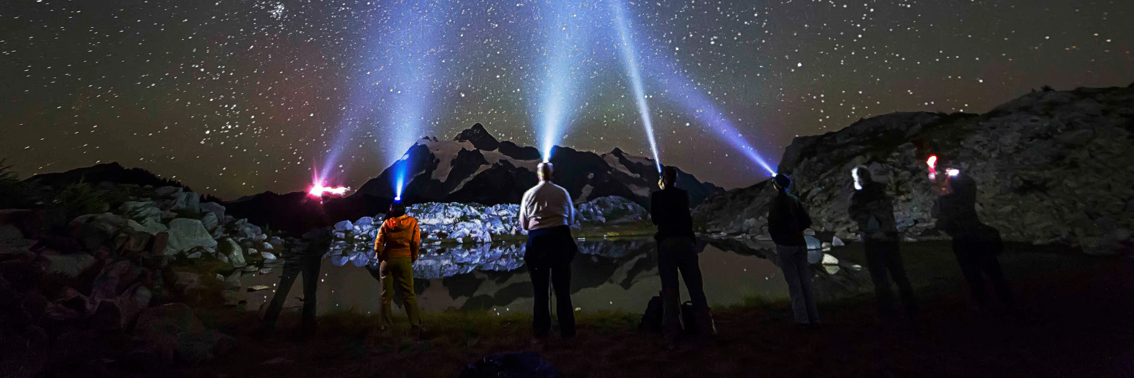
Artist Point is the parking lot at the far end of the Mt. Baker Highway, just over 5,100 feet up, with Mount Baker on one side and Mount Shuksan on the other. The final 2.7 miles are buried in snow most of the year. In 2026 WSDOT reopened them on June 10, and they’re open now. You need a recreation pass to park.
That’s the whole thing in a paragraph. Here’s everything we tell guests who ask us how to do it right.
Is the road to Artist Point open right now?
As of October 10, 2026, yes, though no 2026 seasonal closure date has been announced yet and at this point in the fall it could land any day. WSDOT opened the last 2.7 miles at 7 a.m. on June 10 after clearing as much as 20 feet of snow off the highway and the parking lot. The early-October winter-prep closures below have already come and gone; the seasonal gate is the next thing to watch for. Check WSDOT’s live SR 542 alerts before you drive up — not a blog post, including this one.
| Season | Road to Artist Point opened | Closed for winter |
|---|---|---|
| 2024 | June 21 | Oct 16, 8 a.m. |
| 2025 | June 27 | Oct 15, 10:30 a.m. |
| 2026 | June 10, 7 a.m. | still open as of Oct 10 |
Opening swings by two and a half weeks depending on the winter. The closing date is looser than most people expect, and the two agencies involved describe it differently: WSDOT says the season usually ends between October 15 and November 1, while the Forest Service puts the window at anywhere from the end of September to the beginning of November. Plan an October trip knowing the gate can shut before you get there. We keep the running status on our Artist Point road opening page and our road conditions guide.
There is also a closure most people never see coming: in early October, before the seasonal gate goes down, WSDOT crews do winter prep up top — guardrail, ditches, hazard trees — and that work has shut the upper highway 7 a.m. to 4 p.m. on weekdays in past years while the road was still officially open. Dates are announced about a week out, so check the alerts page before an October drive.
One date that’s already passed this year: Sunday, September 13, 2026, when the Mt. Baker Hill Climb bike race finished at Artist Point and the organizers closed the highway outright: “The highway closes to traffic at 7:00 am sharp and remains closed both eastbound and westbound until 12:00 pm,” per the Baker Hill Climb’s race-day page. The closure ran from Snowater Road up from 7 to 9 a.m., then from Canyon Creek Road up from 9 a.m. to noon. We’re leaving the detail here for anyone checking ahead of a future race weekend: if you’re staying up-valley the Saturday night before, plan to go up in the afternoon instead of the morning.
How far is Artist Point, and how long does the drive take?
Artist Point sits at roughly milepost 57 at the east end of State Route 542, about 23 miles past Glacier. From Glacier plan 45 minutes; from Bellingham plan close to two hours if you stop. The last stretch has narrow, sharp curves and steep sideslopes, which is exactly why WSDOT gates it every winter.
| Starting from | Drive to Artist Point |
|---|---|
| The A-Frame, Glacier | ~40 min to the ski area, then the last few miles to the lot |
| The Red Cabin, Maple Falls | about 1 hour |
| Glacier town center | ~23 miles, about 45 min |
| Bellingham | ~2 hours with stops |
The elevation numbers disagree slightly between agencies, which trips people up. The Forest Service lists the Artist Point trailhead at 5,160 feet; the Forest Service’s own SR 542 byway page says 5,140. Call it 5,100-plus and don’t worry about it. The gain from Glacier is the part your car will notice — about 4,400 feet in 22 road miles, which is why the cyclists make an annual event out of it.
For the stops between Bellingham and the top, we broke the whole corridor down in our mile-by-mile Mt. Baker Highway guide.
What does it cost to park at Artist Point?
Five dollars per vehicle per day, or $30 for an annual Northwest Forest Pass. An America the Beautiful interagency pass covers it too. Buy whichever one before you leave town, because there is no usable cell service at the trailhead and a digital pass you can’t download is not a pass.
| Pass | Cost | Covers |
|---|---|---|
| National Forest day pass | $5 per vehicle, per day | Artist Point and every other fee site up the corridor, that day |
| Northwest Forest Pass (annual) | $30 | Same sites, all year, across Washington and Oregon national forests |
| America the Beautiful (annual) | $80 US residents / $250 nonresidents | All federal recreation land nationwide, national parks included |
If you’re driving down from British Columbia, read that last row again. As of January 1, 2026 the America the Beautiful annual pass costs $250 for nonresidents rather than $80. The Northwest Forest Pass has no nonresident tier — it is $30 for everybody — and it covers everything you’d stop at on this highway. Unless you’re also planning national park trips, the $30 pass is the right buy for a Mt. Baker weekend, and the $5 day pass is the right buy for a single trip up.
The pass covers the other fee sites up the corridor too: Heather Meadows, Picture Lake, Austin Pass, and the trailheads below. One pass, whole day, no per-stop fiddling. If you forget, the Glacier Public Service Center at milepost 34 sells them over the counter daily 8 a.m. to 4:30 p.m. and has a self-service day-pass kiosk that runs 24/7 — the last chance before you lose signal. If you’re already sorting out fuel and groceries for the trip, do the pass at the same time; see our no gas in Glacier services guide for what’s actually available on the way up.
What are the walks from the Artist Point parking lot?
Four trails use the lot as their trailhead, and they range from a stroll to a full day. Artist Ridge out to Huntoon Point is 1.2 miles roundtrip with 200 feet of gain and two accessible vistas right at the start. Table Mountain is 2.6 miles and 725 feet, steep and exposed. Chain Lakes and Ptarmigan Ridge are the bigger commitments. A fifth trail, Wild Goose, connects the lot downhill to Heather Meadows.
| Trail | Roundtrip | Gain | High point | What to know |
|---|---|---|---|---|
| Artist Ridge / Huntoon Point | 1.2 mi | 200 ft | 5,150 ft | Two accessible vistas at the start. Stay on the gravel — the alpine plants here take decades to recover. |
| Table Mountain | 2.6 mi | 725 ft | 5,700 ft | No dogs. Steep, exposed switchbacks that get treacherous with snow, ice, or loose gravel. |
| Chain Lakes Loop | ~6–6.5 mi | ~1,750–1,800 ft | ~5,400 ft (Herman Saddle) | Sources disagree on the exact mileage. Four to four and a half hours is realistic. |
| Ptarmigan Ridge | 9.0 mi | 1,800 ft | 6,100 ft | Snow lingers on the talus into late summer. Beyond 3.8 miles it needs real route-finding. |
| Wild Goose | 1.4 mi | 1,100 ft | 5,100 ft | The connector down to Heather Meadows. Hikers only, no bikes. |
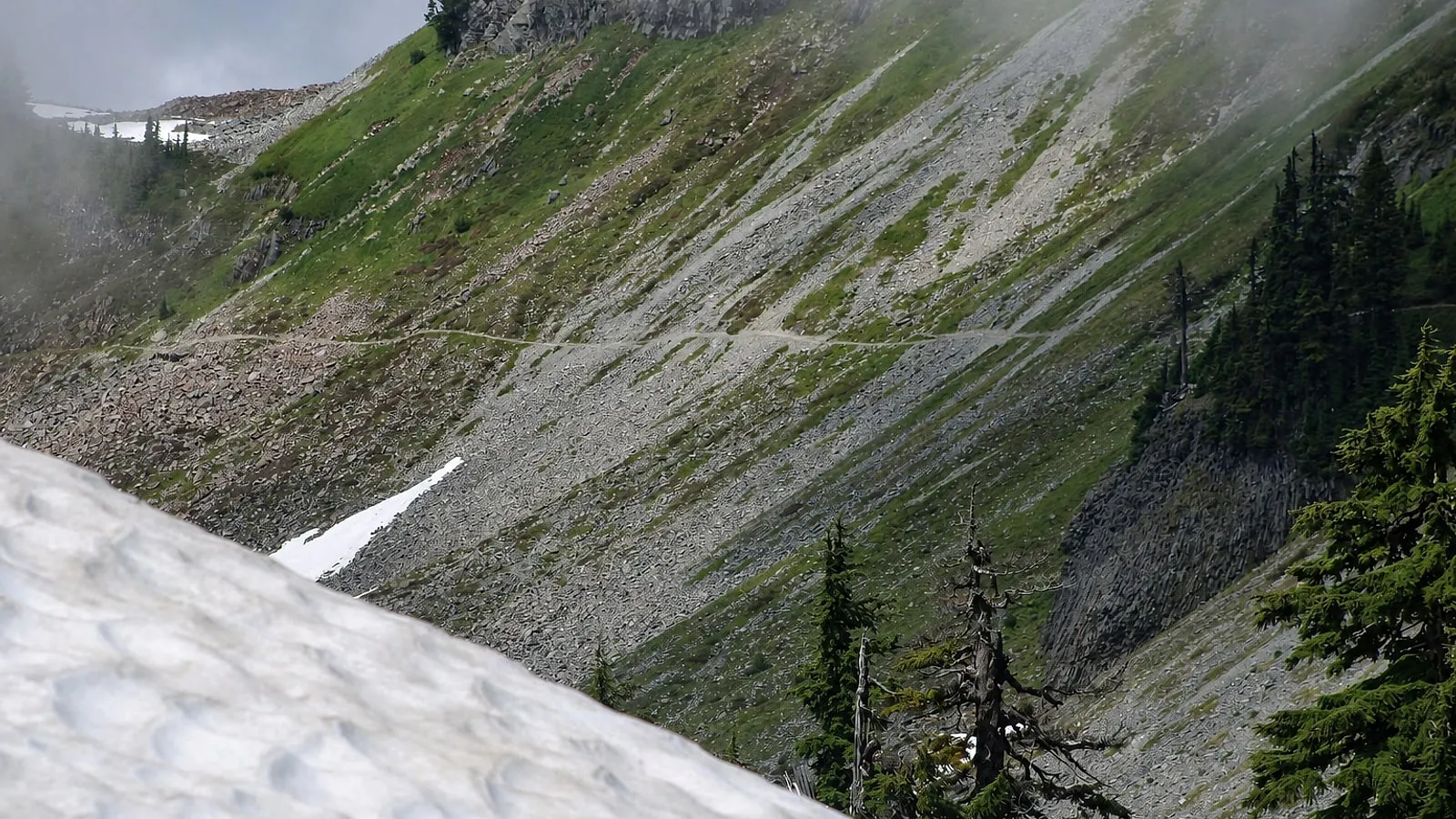 The Table Mountain trail above Artist Point. Photo: Chris Light, CC BY-SA 4.0, via Wikimedia Commons.
Wild Goose is the one most visitors never notice, and it’s the reason you don’t have to end the day where you started. The Forest Service has it running the length of the Heather Meadows area, linking the visitor center, the Austin Pass Picnic Area and Artist Point. WTA’s 1.4 miles and 1,100 feet describe the round trip, which means climbing back up. Walked one way downhill from the lot it’s the short version, and someone has to drive down and collect you at the bottom.
Artist Point is also the one place on this highway you can drive to and see both big peaks at once, which is how most people finally work out that Mt. Baker Ski Area is not on Mount Baker and that the famous reflection shot is Mount Shuksan. The full untangling is in Is Mt. Baker the mountain or the ski area?
The honest caveat on the four that start up top: WTA notes the Artist Ridge corridor is walkable for less than three months a year, and in June and early July “the road is open” and “the trails are clear” are two different statements. WSDOT said as much on opening day this year — the road was clear, most of the trails were still under deep snow, and the directional signs weren’t up yet. More options in our best hikes near Mt. Baker roundup.
What’s worth stopping for on the way up?
Two things, both below Artist Point. Picture Lake at Heather Meadows has a half-mile paved-and-boardwalk path with four entry points, ADA accessible, looking straight at the Shuksan reflection. The Fire and Ice interpretive loop is another half mile, with the first quarter paved. You reach it off the Austin Pass Picnic Area turnoff near milepost 55 and park by the visitor center; the trailhead is at the southwest side of the lot.
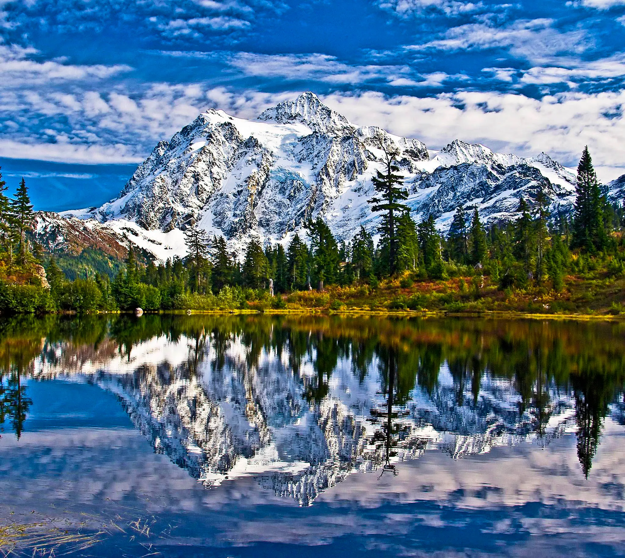 Picture Lake, milepost 54. The half-mile loop is the most photographed half mile in Whatcom County.
The Austin Pass Picnic Area, about 1.5 miles below Artist Point, has the only picnic tables in the upper corridor. The Heather Meadows Visitor Center sits at mile 55 and runs mid-July to late September, daily 10 a.m. to 4 p.m. It closes after the last weekend in September, which in 2026 means Sunday, September 27 — worth knowing, because late September is also when the cascade blueberry turns deep red through the whole basin and the crowds arrive for it. Where that color actually is, and when, is in our Mt. Baker fall color guide.
When should you go to avoid the crowd?
Early or late. WSDOT counts roughly 650 vehicles a day at Artist Point once the road reopens, and the lot fills on sunny summer weekend mornings.
Evening is our pick. The crowd thins after about 6 p.m., the light comes across Shuksan instead of into your lens, and the drive back down is empty. Carry a headlamp, because there is no lighting anywhere up there and no cell signal to call anyone if you misjudge it.
Sunset moves fast this time of year, and people plan an evening in August that no longer works in September. At Artist Point the sun set at 8:02 p.m. on August 26, 2026. It’s 7:48 p.m. by September 2, 7:21 p.m. by September 15, and 6:55 p.m. by the 27th. That’s about three and a half minutes of daylight lost per day heading into the equinox, not the two most people assume. Back the drive time out from those numbers rather than from what worked last month.
| Date | Sunset at Artist Point |
|---|---|
| Aug 26 | 8:02 p.m. |
| Sept 2 | 7:48 p.m. |
| Sept 15 | 7:21 p.m. |
| Sept 27 | 6:55 p.m. |
What’s actually at Artist Point — and what isn’t?
A vault toilet, garbage cans, and the view. That’s the list. No potable water, no picnic tables, no food, no gas, no dependable cell service. Vault toilets are summer-only and closed in winter. The nearest food is the Heather Meadows Day Lodge, a couple of miles back down.
A few rules people get wrong:
- No camping May 15 to November 15, and that includes sleeping in a car, van, or RV in the lot.
- No fires or charcoal, year-round — that one is specific to Artist Point and never lifts. Self-contained gas and propane stoves are allowed. The separate forest-wide campfire ban that ran through the summer has been rescinded effective September 15, 2026, and Cascades North fire danger is back to Moderate — but that changes nothing at Artist Point itself.
- Dogs on leash everywhere except Table Mountain, where they’re not allowed at all.
- The Heather Meadows Cafe and Summer Mountain Shop run Friday through Monday, 11 a.m. to 5:30 p.m., closed Tuesday through Thursday. They opened for the 2026 season on July 3, and the mountain has now posted a closing day: Sunday, September 13, 2026. The road stays open well past that, so for most of the autumn there is no food at the top of the highway at all — the last of it is back down in Glacier. Everything else you can eat on this highway is in our where to eat near Mt. Baker guide.
- The Glacier Public Service Center at milepost 34 is open daily 8 a.m. to 4:30 p.m. and has current road and trail conditions. It’s the last reliable information you’ll get before you lose signal.
Can you get to Artist Point in winter?
Not by car. WSDOT gates the last 2.7 miles at Heather Meadows, milepost 54, usually in October. You can snowshoe or skin it — WTA puts the winter route at 4 miles roundtrip and about 1,000 feet of gain, no pass required — but it crosses avalanche terrain, and the south face of Table Mountain is the specific slope to stay off.
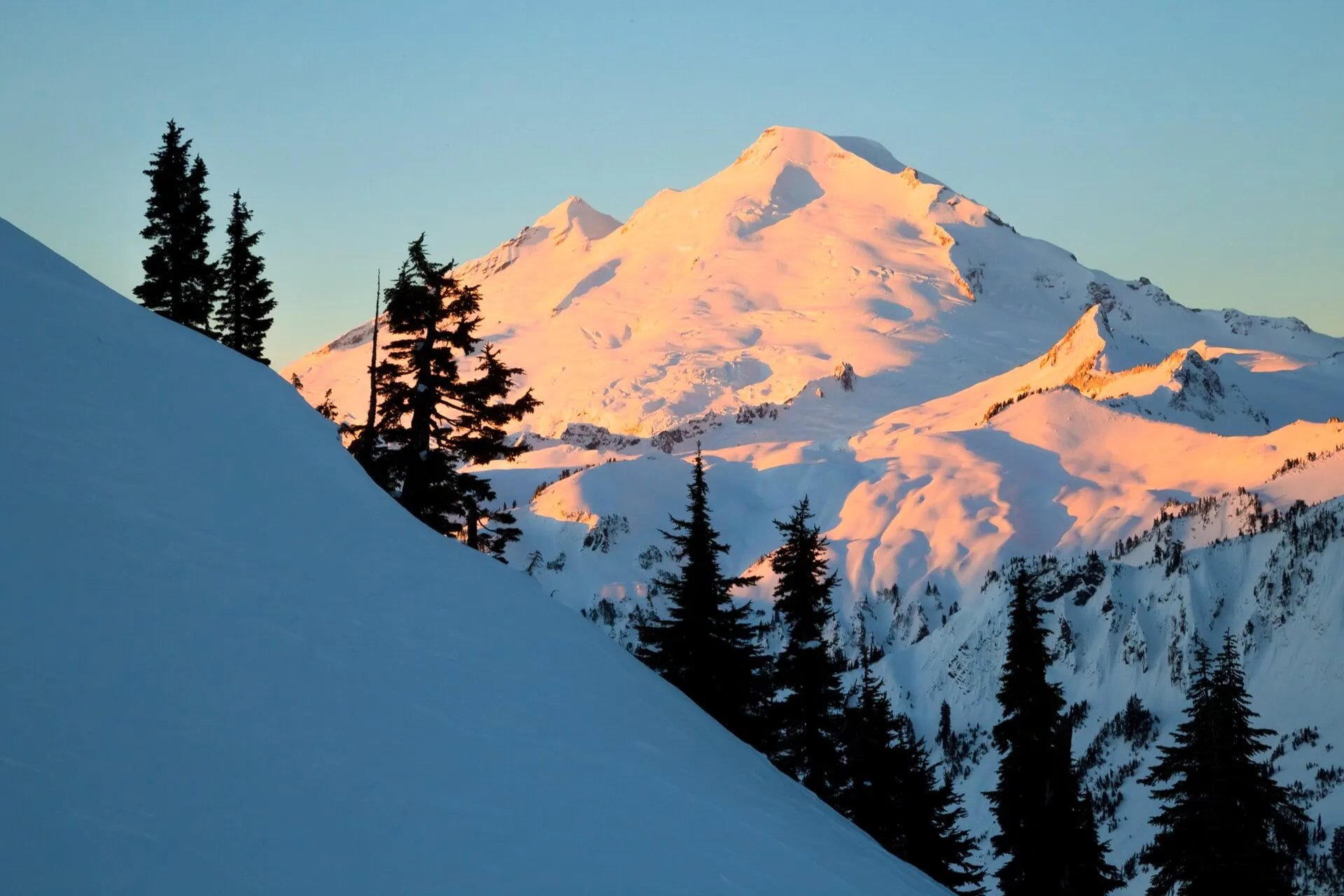 The same parking lot in winter. The gate at milepost 54 is where the plowing stops.
We are not avalanche educators, and we won’t pretend otherwise. Read the NWAC forecast for the West Slopes North zone before you leave the cabin, and if you can’t confidently interpret it, this is not the day to learn. Getting up the highway at all in winter is its own subject — see our guide to chains and winter driving on SR 542.
Where do you stay to be at Artist Point early?
There is no lodging at Mt. Baker Ski Area and none at Artist Point. The nearest beds are down SR 542 in Glacier and Maple Falls. From Glacier you can be parked at the lot well before the day crowd comes up from Bellingham; from Maple Falls it’s about an hour, and cheaper for the extra fifteen minutes.
We host both. Our black A-frame near Glacier is the closest to the mountain, with a stargazing hot tub, a cedar barrel sauna back in the woods, and a free espresso bar for the 5 a.m. version of this plan. Our red cabin in Maple Falls is the renovated 2-bedroom with a private hot tub and a fire pit, listed at about an hour from Artist Point in summer. Both are strictly no-pets, so plan the dog around that before you book.
After a Chain Lakes day, the hot tub is the point. That’s not marketing — it’s what our guests actually do, and it’s why we compare every option in the corridor on our where to stay at Mt. Baker guide and our cabins with a hot tub page. Booking on this site gets you our best rate, direct from the owners.
Last verified August 26, 2026 against WSDOT, the Mt. Baker-Snoqualmie National Forest, the National Park Service, Washington Trails Association, Cascadia Daily News, the Baker Hill Climb and Mt. Baker Ski Area. Road status, pass prices, and cafe hours all change. Check the WSDOT SR 542 alerts page the morning you go.