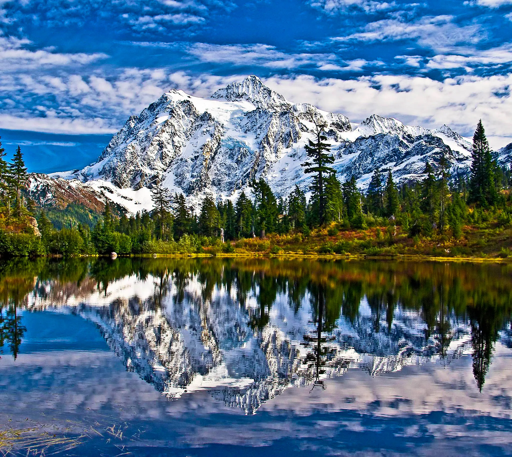
Fall color at Mt. Baker peaks between mid-September and mid-October, and it happens close to the ground: huckleberry and blueberry bushes turning crimson across Heather Meadows, with mountain ash going orange behind them. There are no larches here. Both of Washington’s larch species grow east of the Cascade crest. The season ends when WSDOT gates the last stretch of road to Artist Point, usually between October 15 and November 1.
We host two cabins in this valley and answer some version of this question every September, usually from someone who saw a golden-tree photo and assumed it was taken up our highway. Here is the honest version.
When do fall colors peak at Mt. Baker?
The high country turns first. Heather Meadows and Artist Point sit between roughly 4,100 and 5,150 feet, and the shrubs up there usually color up from mid-September through the first week of October. The valley floor around Glacier and Maple Falls runs three to four weeks behind. A single early storm can end the high season overnight.
Daylight is the other thing that shifts fast. At Artist Point, sunset falls around 7:20 p.m. on September 15 and around 6:20 p.m. by October 15 — that hour matters when you are planning a two-hour drive back down the mountain on a road with no lighting and no shoulder in places.
Here is what we watch turn, and roughly when. This is our own observation from living here, not a published schedule, and it moves a week or two either way depending on the summer.
| Where | What turns | Rough peak |
|---|---|---|
| Artist Point & Heather Meadows (4,100–5,150 ft) | Huckleberry and blueberry bushes (red), mountain heather, mountain ash | Mid-Sept to early Oct |
| Upper-valley trails above ~3,500 ft | Same low shrubs, plus alpine grasses going straw-gold | Late Sept |
| Nooksack valley floor: Glacier, Maple Falls, the river bottoms | Vine maple, bigleaf maple, cottonwood, alder | Mid-Oct into early Nov |
The practical takeaway: if you want the alpine color, come in late September. If you want the classic yellow-maple-over-a-river look, come in the second half of October, when the alpine is already under snow. If you are still choosing a month at all, our month-by-month guide to the best time to visit Mt. Baker sets autumn against the rest of the year.
Why are there no larches at Mt. Baker?
Because larches are east-side trees. Washington has two species, and the Washington Trails Association’s field guide puts both of them on the dry side of the crest: western larch between 2,000 and 5,500 feet, and subalpine larch between 5,800 and 7,500 feet. Mt. Baker is on the wet side. Nothing at Heather Meadows turns gold like that.
The reason is ecological, not elevation. Larches are extremely shade-intolerant, so they need open, frequently disturbed, fire-shaped forest to hold ground. WTA describes subalpine larch’s range as running north from the Wenatchee Mountains into British Columbia and Alberta, and east into northern Idaho and Montana — country that burns. Our west-slope forest is dense, wet mountain hemlock and silver fir, and it closes over any larch seedling that tries.
So when a photo essay, a Pinterest board, or an AI travel answer tells you to see golden larches at Artist Point, it is simply wrong. What you will actually get in late September is a whole basin of red — which we would argue photographs better against Shuksan anyway, and which almost nobody writes about honestly.
Where do you drive for golden larches instead?
The North Cascades Highway, SR 20, near Rainy Pass. Blue Lake and the Heather–Maple Pass Loop are the two classic larch hikes, both best in the last week of September into the first two weeks of October. There is no road east out of the Nooksack valley, so this is a full-day trip: back down to Bellingham, south on I-5, then east on SR 20.
| Larch hike (SR 20) | Distance | Gain | High point | Pass |
|---|---|---|---|---|
| Blue Lake | 4.4 mi roundtrip | 1,050 ft | 6,254 ft | NW Forest / America the Beautiful |
| Heather–Maple Pass Loop | 7.2 mi loop | 2,020 ft | 6,650 ft | NW Forest / America the Beautiful |
Both trailheads are notorious for filling before sunrise during larch season. If you are staying with us and want to do this, treat it as a dawn departure, not a leisurely morning.
Where should you actually look for fall color at Mt. Baker?
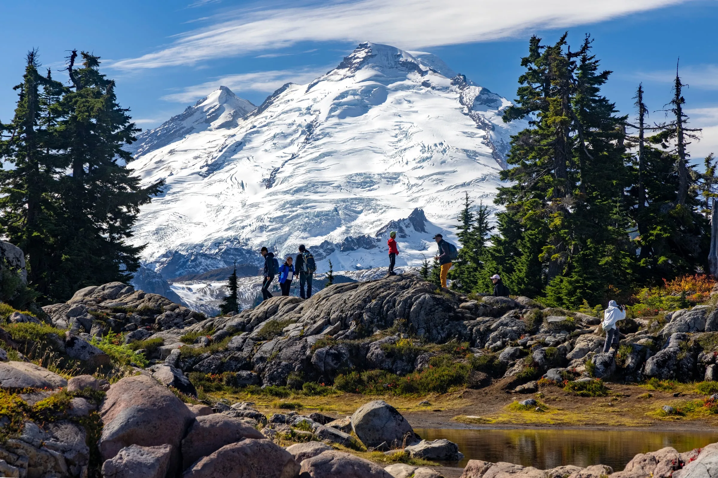
Everything worth seeing sits in the last four miles of the Mt. Baker Highway, between Picture Lake at milepost 54 and Artist Point at the end of the pavement. You can get the best of it from a half-mile paved loop, or you can earn a whole cirque of red on a hard day hike. All of these need a recreation pass on the dash.
| Walk or hike | Distance | Gain | High point | Who it’s for |
|---|---|---|---|---|
| Picture Lake | 0.6 mi loop | 45 ft | 4,157 ft | Everyone — ADA-accessible path, the Shuksan reflection shot |
| Artist Ridge to Huntoon Point | 1.2 mi roundtrip | 200 ft | 5,150 ft | Best color-per-step on the mountain |
| Bagley Lakes | 2.0 mi roundtrip | 150 ft | 4,300 ft | Families; starts from the ski area lot |
| Chain Lakes Loop | 6.5 mi loop | 1,820 ft | 5,400 ft | The marquee fall hike — blazing color over Herman Saddle |
| Yellow Aster Butte | 7.5 mi roundtrip | 2,550 ft | 6,150 ft | Strong hikers; the tarn basin turns orange and red |
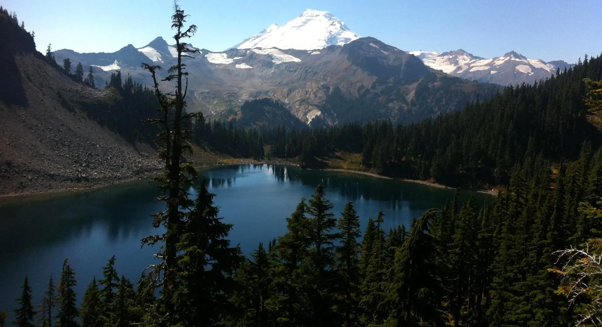 Iceberg Lake on the Chain Lakes route. Photo: Dan Ust, CC BY-SA 4.0. Edited. An archival landscape view, not a report of today’s trail conditions.
Four trails leave directly from the Artist Point lot in summer — Chain Lakes, Ptarmigan Ridge, Table Mountain and Artist Ridge — per the Forest Service. For the rest of the season’s options, we keep a wider list in our hikes near Mt. Baker guide.
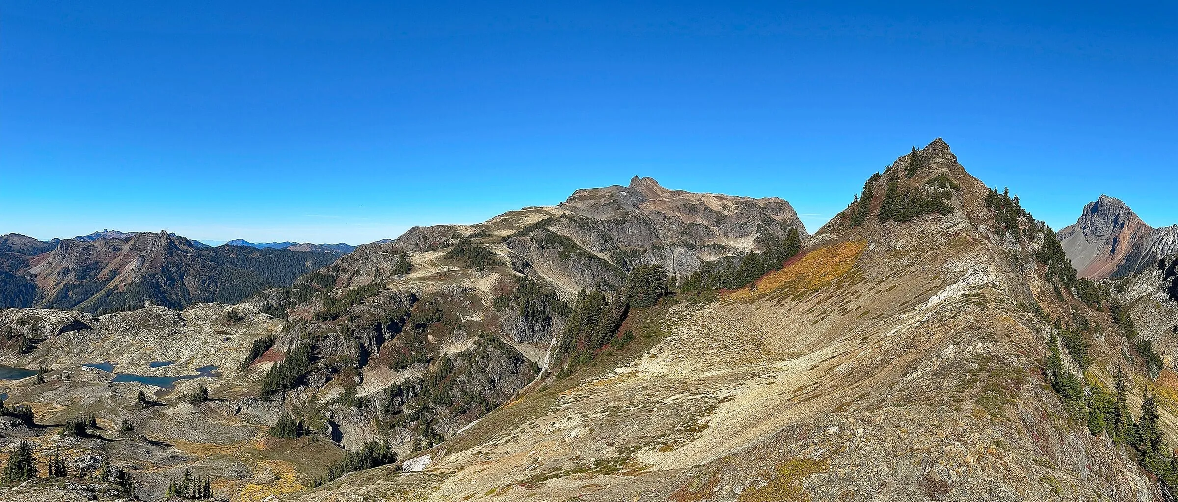 The Yellow Aster Butte tarn basin in autumn. This is what “fall color at Mt. Baker” actually looks like — huckleberry going red across open slopes, not a golden tree in the frame. Our Yellow Aster Butte trail guide has the road, the parking situation and the Forest Service rules for the tarns.
Where is the fall color once the alpine is done?
On the valley floor, three to four weeks later. The Nooksack bottomlands around Glacier and Maple Falls run on bigleaf maple, vine maple, cottonwood and alder, and they peak from mid-October into early November — usually after WSDOT has already gated Artist Point. It is a different trip: yellow over water instead of red over rock.
Two of the easiest places to walk into it are free, low, and open long after the alpine is under snow. Maple Creek Park at the edge of Maple Falls is an easy loop through second-growth maple with a creek crossing and a run of small waterfalls, no pass required. Silver Lake Park, a few miles north of town, has miles of lakeshore trail and free day use. We wrote up both in our Silver Lake Park guide.
Valley walk update, checked September 9, 2026: Whatcom County lists the Lagoon Bridge at Silver Lake Park as closed, so do not plan on an uninterrupted lakeshore loop. The county describes Maple Creek Loop as moderate and 1.3 miles. Choose your walk for current footing and weather, not just distance.
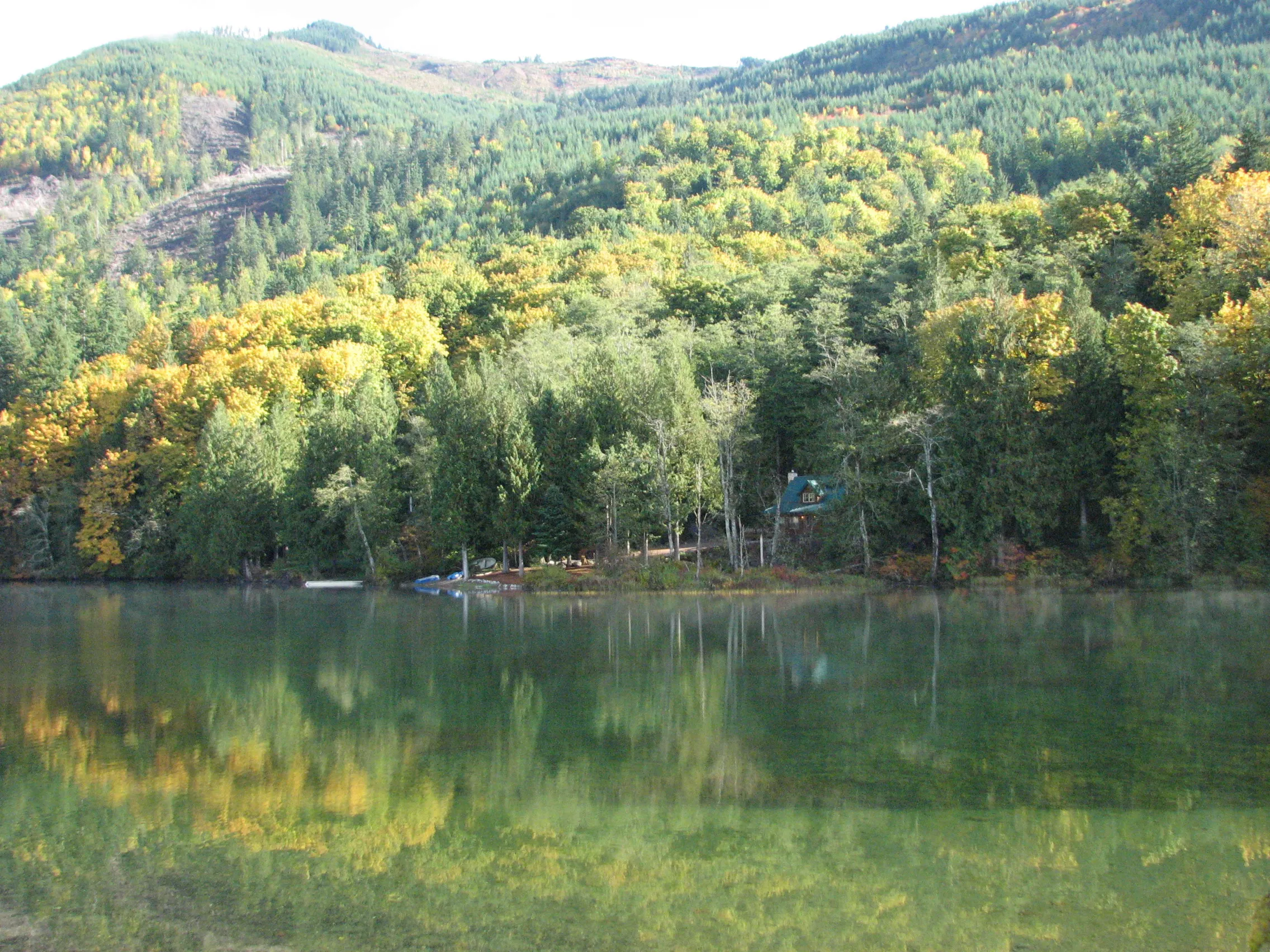 Valley foliage at Silver Lake in an archival October photograph. The building across the lake is not one of our cabins. Photo: Steven Pavlov, CC BY-SA 4.0.
,_16.jpg)
The other thing late October gives you is an empty corridor. The pullouts are open, the trailheads are not full at 9 a.m., and the drive itself is the attraction — our mile-by-mile highway guide covers the stops. Shoulder-season hours do shift, so check before you count on a meal: we keep every kitchen’s current days in the where to eat near Mt. Baker guide.
How late can you drive to Artist Point?
Until the first real snow. WSDOT gates the final 2.7 miles at Heather Meadows each fall and says the road usually closes between October 15 and November 1. In 2025 it opened June 27 and closed at 10:30 a.m. on October 15. In 2026 it opened June 10 after crews cleared as much as 20 feet of snow.
Do not treat October 15 as a floor. WSDOT’s window is what usually happens; the Forest Service’s own trailhead page puts the real range wider, saying the road closes after the first significant snowfall, which “can happen anytime between the end of September - beginning of November”. If your trip is built around standing at Artist Point in late September, have a Heather Meadows plan in your back pocket.
One thing you cannot do up there: sleep. Camping is prohibited at Artist Point from May 15 to November 15, per the same Forest Service page, which rules out the car-camp-for-sunrise plan people arrive with every autumn. You are driving up in the dark or you are not getting first light.
The part most guides get wrong: closing that gate does not close the fall color. The gate sits at Heather Meadows, milepost 54, and SR 542 stays open to that point year-round because the ski area operates there. Picture Lake, Bagley Lakes and the Heather Meadows basin are still drivable after Artist Point shuts. You lose the highest 1,000 feet and the Artist Ridge walk, not the trip.
We track the gate on our Artist Point road status page, and the full breakdown of the viewpoint itself is in our Artist Point guide. For live conditions on the whole highway, start at our road conditions page.
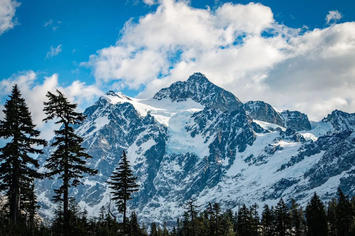 Mount Shuksan in a different season, from our existing regional photo library. Snow and visibility change the trip; check the forecast before leaving the valley.
If rain changes your plans, our Mt. Baker rainy-day guide offers shorter valley outings and indoor alternatives.
What is already closed by the time the color peaks?
More than you’d expect. The Heather Meadows Visitor Center runs daily 10 a.m. to 4 p.m. and closes for the season after the last weekend in September — September 27 this year, which is right when the alpine color arrives. Plan on no staffed building, no restroom guarantees, and no last-minute map purchase up top. The Glacier Public Service Center at milepost 34 stays open daily 8 a.m. to 4:30 p.m. and becomes your only staffed stop on the highway.
The Heather Meadows Cafe at the day lodge runs Friday through Monday, 11 a.m. to 5:30 p.m., and the mountain has now posted its closing day for the 2026 summer season: Sunday, September 13. That is the front edge of the color window, not the back of it — for most of the peak you are driving up to a closed building. Bring lunch. The last real food on the way up is in Glacier at milepost 34, and there is none above it.
One trail to strike off your list entirely: Skyline Divide. Forest Road 37 has been closed at mile 3.1 since 2021 flood damage, with no estimated repair date. It still shows up on “best fall hikes” lists every single year. You cannot drive to the trailhead.
And the corridor basics don’t change in autumn: there is no gas station in Glacier, and cell service is unreliable past Kendall. We wrote the whole services reality check in no gas in Glacier.
Can you have a fire on a fall trip?
Check the current restriction for the place where you intend to have a fire. National forest land and county-regulated private property can have different rules, and those rules change during autumn. A fire pit appearing in a cabin photograph is not a promise that you can use it on your dates.
For forest land, consult the Mt. Baker–Snoqualmie National Forest’s current alerts. For the cabins, check Whatcom County’s outdoor burning information and the arrival instructions. If a restriction is unclear, leave the fire unlit until you have confirmation. The private hot tubs give you another way to spend the evening outside when conditions allow.
What pass do you need to park?
A recreation pass, on the dash, at every trailhead here. The Forest Service sells a Northwest Forest Pass at $5 per day or $30 for the year; the America the Beautiful interagency annual pass is $80 for residents and is honored in its place. A Washington Discover Pass is not valid at Forest Service sites — that one catches people constantly.
Artist Point’s main lot holds roughly 250 vehicles and fills fast on sunny weekends, with overflow parking below. There is Scan & Pay and a recreation.gov app option at the trailhead, but buy your pass before you leave the valley — you will not have signal up there. In person, the Glacier Public Service Center at milepost 34 lists daily hours of 8 a.m. to 4:30 p.m.
The one September morning you cannot drive up the mountain
Sunday, September 13, 2026. The Mt. Baker Hill Climb sends 450 cyclists 22 miles from Glacier to Artist Point, and SR 542 closes to traffic from 7 to 9 a.m. between Snowater Road and Artist Point, then from 9 a.m. to noon between Canyon Creek Road and Artist Point.
If you are staying up-valley that weekend, you are not driving to the trailheads before lunch. Sleep in, take the morning slow, and go up in the afternoon when the light is better anyway. It is the single most common trip-planning surprise we head off in September.
Where to stay for a Mt. Baker fall trip
Fall is the shoulder season nobody books properly, which is exactly why we like it — the alpine is red, the highway is quiet, and the hot tubs are far more appealing at 45 degrees than at 80.
Our A-frame sits on a forested lot near Glacier, about 40 minutes below the ski area and the closest of our two to the color. It sleeps 6 across three bedrooms, and after a cold day at Chain Lakes the sequence is the cedar barrel sauna out in the woods, then the outdoor shower, then the hot tub. There is a free espresso bar for the pre-dawn larch-drive mornings.
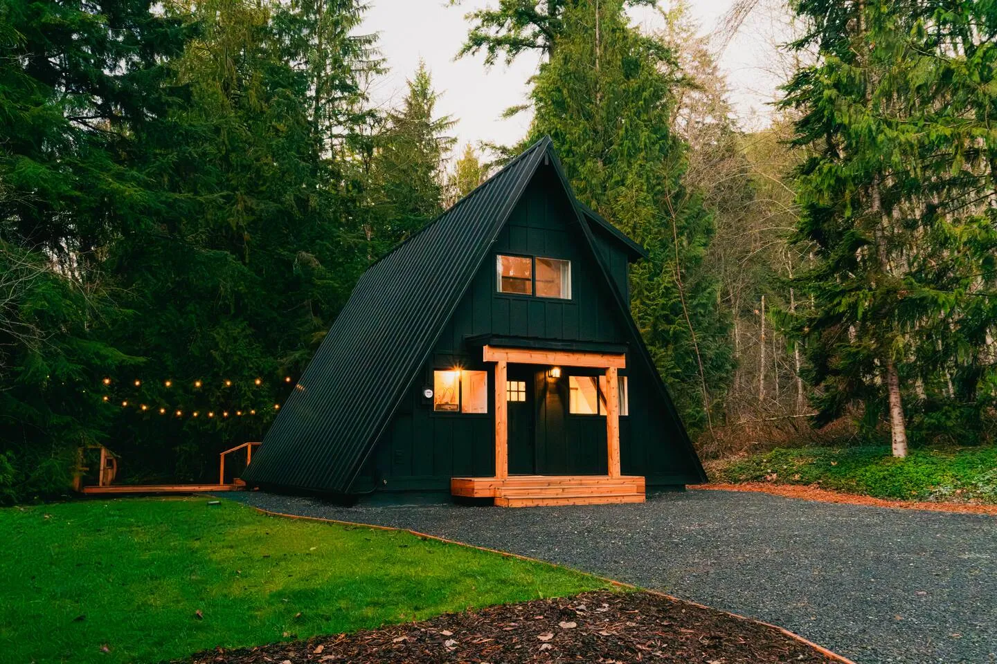 The Black Cedar near Glacier. Photo: Red Mountain Cabins.
Our red cabin is in Maple Falls, 15 minutes further down the valley and 45 minutes from the ski area. It sleeps 4, has a private hot tub under the trees and a fire pit in the back, and it is the cheaper of the two for that extra drive time.
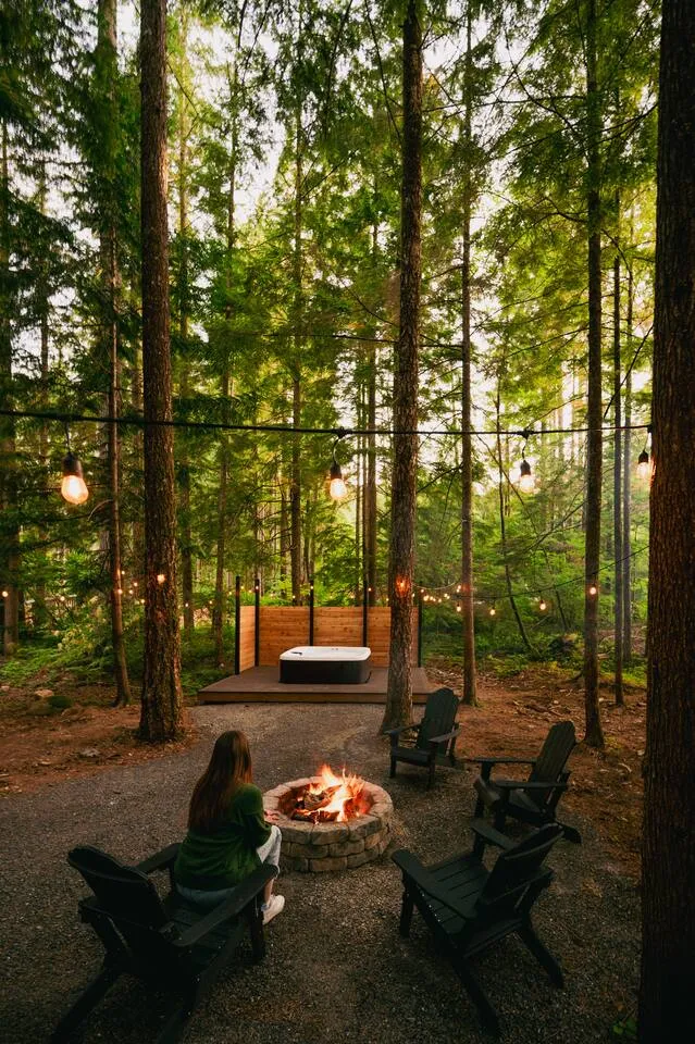 An archival view of The Little Red Cabin’s outdoor area. Wood fires are only available when current restrictions allow them. Photo: Red Mountain Cabins.
Both cabins have a strict no-pets policy. If you are still comparing towns and options, our Mt. Baker lodging guide lays out the whole corridor, and the cabins with hot tubs page covers what actually matters in October. Booking here gets you our best rate, direct from the owners.
Come the last week of September if you want the red, the third week of October if you want the maples, and check the WSDOT gate before you commit to Artist Point either way.