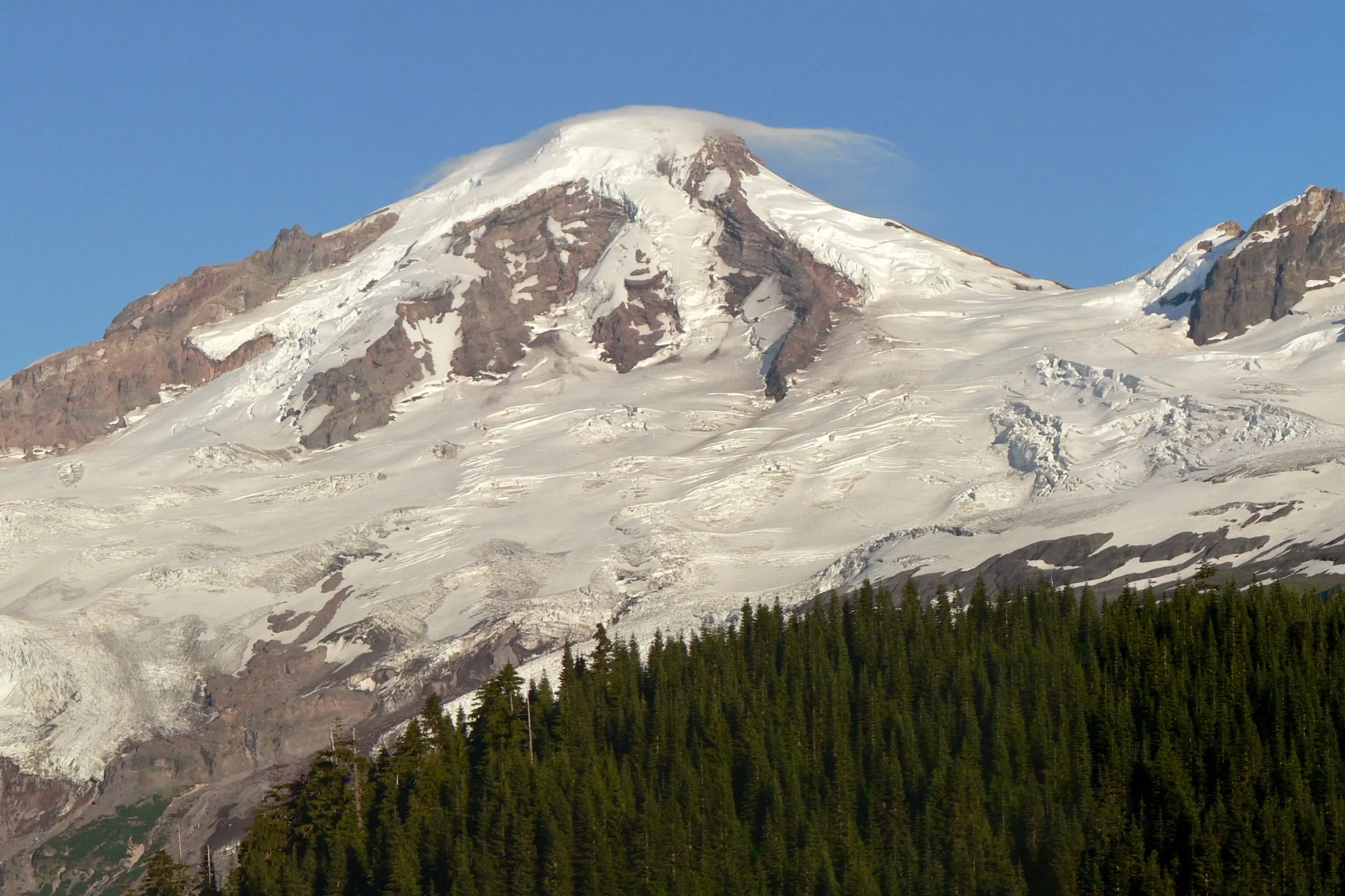
Both, and they are about nine miles apart. Mount Baker is the 10,781-foot glaciated volcano you can see from Seattle on a clear day. Mt. Baker Ski Area is a separate place at the end of State Route 542, sitting closer to Mount Shuksan than to Baker, with no road, lift or day hike connecting it to the volcano. And the mountain in almost every famous “Mt. Baker” photograph is Shuksan.
We get some version of this question every winter, usually from someone who has booked a trip and then noticed the pictures do not match. None of it is anyone’s fault. The ski area, the highway, a school district, a reservoir and a Seattle neighborhood all carry the name, and they are spread across two counties and a hundred miles. Here is what is actually what.
Is Mt. Baker Ski Area on Mount Baker?
No. The ski area sits at 48°51′43″N 121°39′14″W, roughly nine miles northeast of Mount Baker’s summit and roughly three miles from Mount Shuksan’s. Wikipedia’s own article on the ski area puts it plainly: it “is actually closer to Mount Shuksan than Mount Baker.” The ski area is named for the volcano it looks at, not the one it is built on.
The lift-served terrain runs across the ridges and bowls around Heather Meadows. By the ski area’s own mountain stats, the White Salmon base area is at 3,500 feet, the Heather Meadows base at 4,300, and the top of Chair 8 at 5,089 — a vertical rise of 1,500 feet across eight quad chairs, two handle tows and about 1,000 acres. Mount Baker’s summit is more than twice the height of the highest lift on the hill, and you cannot reach it from any of them.
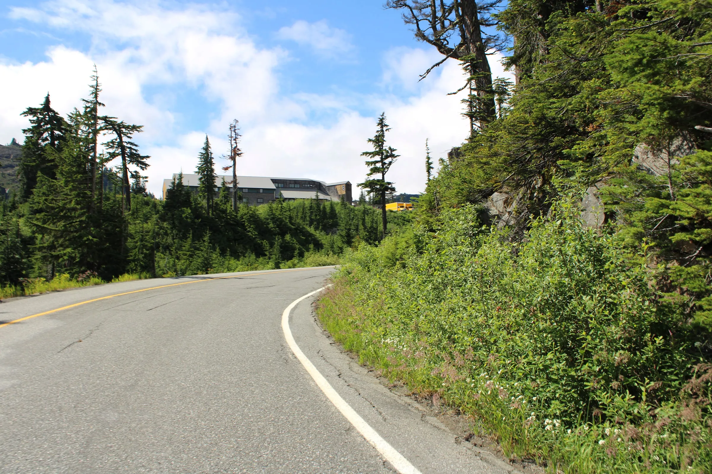 The White Salmon base area at 3,500 feet, from SR-542 in summer. This is Mt. Baker Ski Area. No volcano in the frame, and none visible from the parking lot. Photo: Chris Light, CC BY-SA 4.0. Cropped and tonally adjusted.

What mountain is in all the “Mt. Baker” photos?
Usually Mount Shuksan, 9,131 feet, which is not a volcano at all — it is a glaciated massif of metamorphosed oceanic rock, built by tectonic collision rather than eruption. The reflection shot taken at Picture Lake, the one on the calendars and the tourism brochures, is Shuksan. Mount Baker is out of frame, behind the photographer’s right shoulder.
This is the single most useful thing to know before you arrive. Shuksan is what you see from Picture Lake, from the base areas, and from most of the lift terrain. Mount Baker shows itself from the higher ground and, most reliably, from the road-end viewpoint at Artist Point.
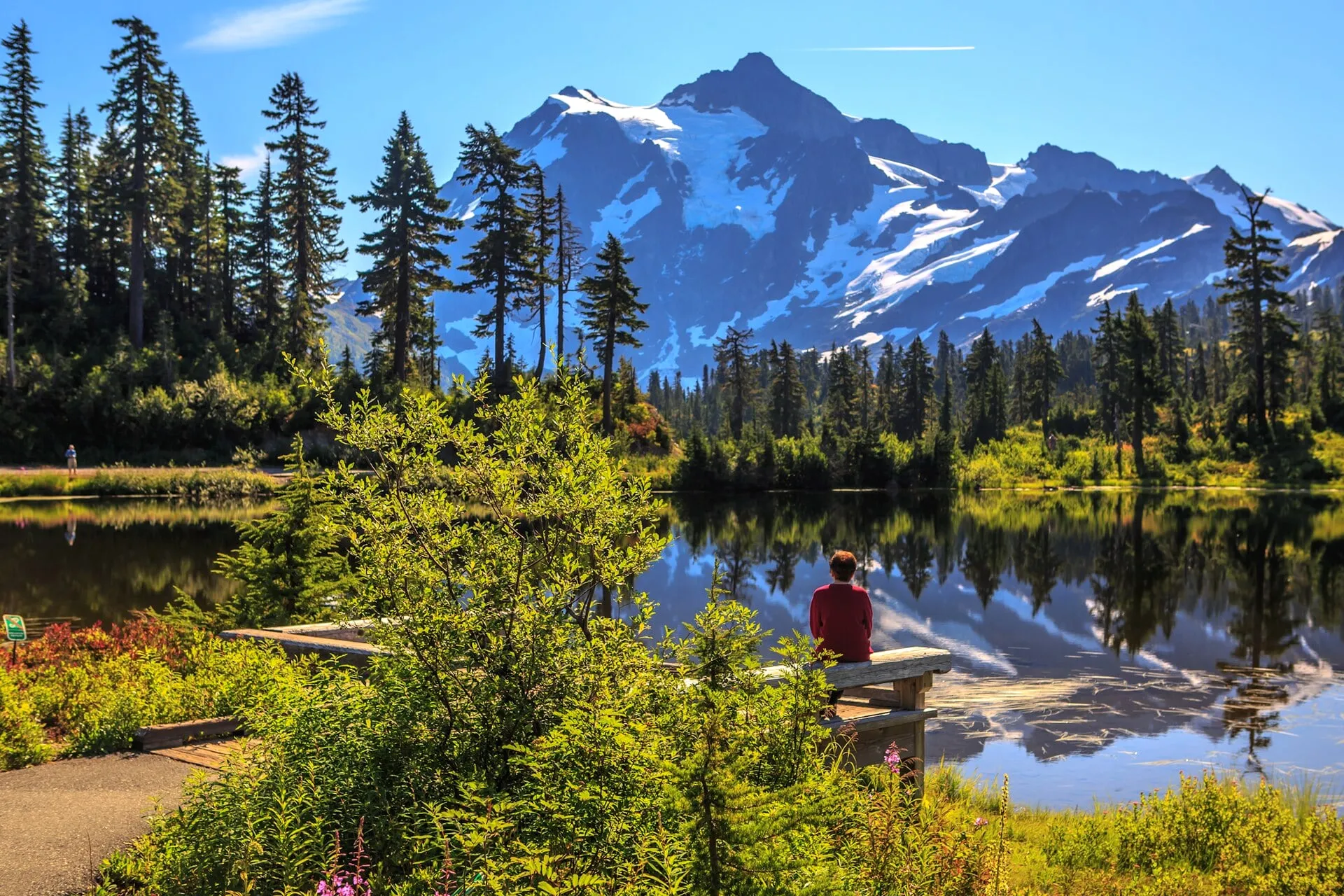 Picture Lake, on the loop road just below the ski area. The peak is Mount Shuksan, not Mount Baker — this is the photograph most people have in mind when they book. Photo: Murray Foubister, CC BY-SA 2.0. Cropped and tonally adjusted.
.jpg)
The two mountains are about ten and a half miles apart and belong to different agencies. Mount Baker is national forest land inside the 117,900-acre Mt. Baker Wilderness; Mount Shuksan’s summit is inside North Cascades National Park, whose boundary runs along the ridges east of the ski area.
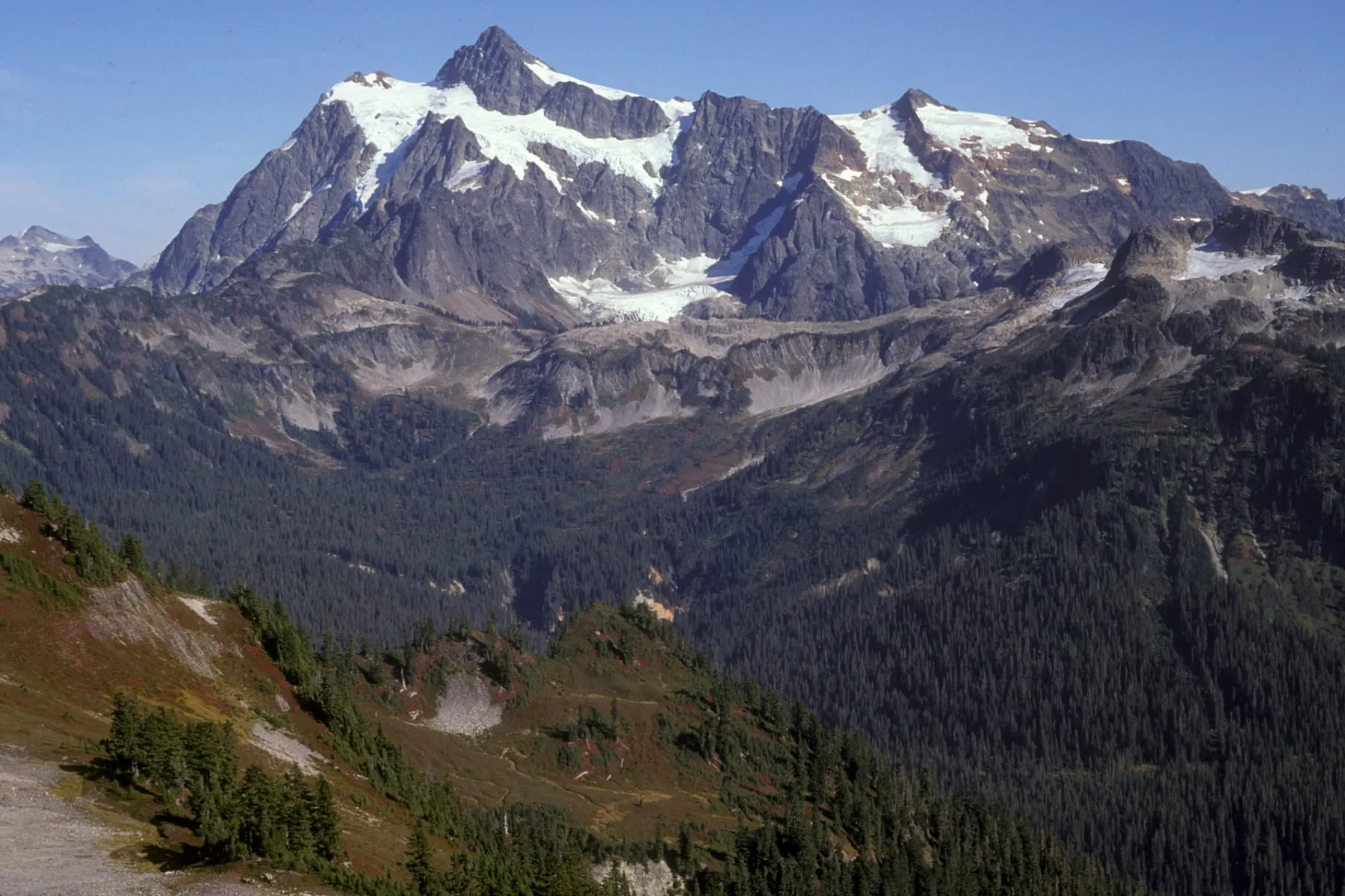 The view from the Mt. Baker Ski Area side. Everything filling the frame here is Mount Shuksan; its summit is in North Cascades National Park while the ground you are standing on is national forest. Photo: U.S. Forest Service, Pacific Northwest Region, public domain. Cropped and tonally adjusted.
.jpg)
What do people actually mean when they say “Mt. Baker”?
Seven different things, depending on who is talking. This is the table we wish existed when guests start planning.
| When someone says “Mt. Baker” | What they mean | Where it is |
|---|---|---|
| The mountain | Mount Baker, a 10,781-ft active stratovolcano | Mt. Baker Wilderness, Whatcom County. No road reaches it |
| The ski area | Mt. Baker Ski Area — 8 quad chairs, 2 handle tows, ~1,000 acres | End of SR-542, ~9 mi from the volcano |
| The highway | SR-542, the Mt. Baker Highway and Mt. Baker Scenic Byway | Bellingham east to Artist Point |
| “A weekend at Mt. Baker” | Staying in Glacier or Maple Falls | The two corridor towns, 30 and 45 min below the lifts |
| Mount Baker, Seattle | A residential neighborhood on Lake Washington | Southeast Seattle, ~100 mi from the volcano |
| Mount Baker School District | The public schools serving the valley | Deming, in the lower Nooksack valley |
| Baker Lake | A reservoir on the volcano’s south side | Skagit County, off SR-20 |
The Seattle one catches people out more than you would expect. That neighborhood sits between Leschi and Seward Park on Lake Washington and was named, per HistoryLink, for the volcano that dominates its distant northeast view. Search “Mount Baker restaurants” from out of state and you may well be reading about a city neighborhood two hours south of the snow.
Does the Mt. Baker Highway go to Mount Baker?
No. SR-542 runs east from Bellingham and stops at Artist Point, a parking lot and viewpoint at 5,160 feet. It never touches the volcano. Its final 2.7 miles are buried in snow for most of the year — WSDOT reopened them on June 10, 2026, and they close again with the first heavy snow.
For most of its length the Mt. Baker Highway is a two-lane road through forest with no view of any big mountain at all. That is worth knowing if you are driving up expecting a scenic reveal; the reveal is at the very end. Our mile-by-mile guide to the highway covers what is actually along it, and current conditions live on our road conditions page.
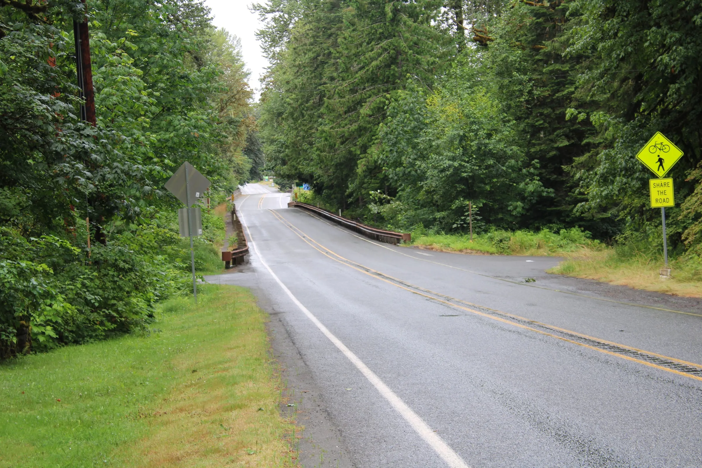 SR-542 on the approach to Glacier. This is the Mt. Baker Highway for most of its length — trees, river, no mountain. Photo: Chris Light, CC BY-SA 4.0. Cropped and tonally adjusted.

Artist Point is the one place you can drive to, in season, where the confusion resolves itself in front of you. The Forest Service description is accurate: “Mt. Baker and Mt. Shuksan are the dominant peaks and on a clear day one can make out the top of distant Mt. Ranier.” Stand at the stone wall and both are there, in opposite directions, obviously different mountains. Our complete Artist Point guide covers timing, parking and the short trails from the lot.
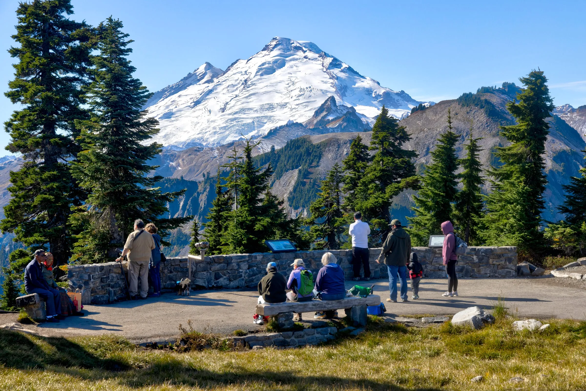 The Artist Point overlook at 5,160 feet, at the end of SR-542. This is Mount Baker, from the only viewpoint on the corridor you can reach by car. Photo: U.S. Forest Service, Pacific Northwest Region, public domain. Cropped and tonally adjusted.
.jpg)
How do you actually get close to Mount Baker itself?
On foot, from Glacier Creek Road. The Forest Service directs hikers about a mile east of the Glacier Public Service Center onto Forest Road 39, then eight miles up it to the Heliotrope Ridge trailhead. The trail climbs through old growth to a moraine overlook of the Coleman and Roosevelt Glaciers — 5.5 miles round trip and 1,400 feet of gain, topping out near 5,100 feet.
That overlook is as close as a walk gets you. The Forest Service is blunt about what comes next: the glaciers are for people with alpine climbing gear and experience, and the creek crossings on the way in can turn from an easy step to a genuine hazard between morning and afternoon as the day’s meltwater arrives. Above the moraine, the 10,781-foot summit is a roped glacier climb, not a hike.
From the other end of the highway, the Ptarmigan Ridge trail leaves Artist Point and walks toward the volcano along a high ridge, which is the closest most people get to standing in front of it without leaving the pavement for long. Both are in our guide to the best hikes near Mt. Baker.
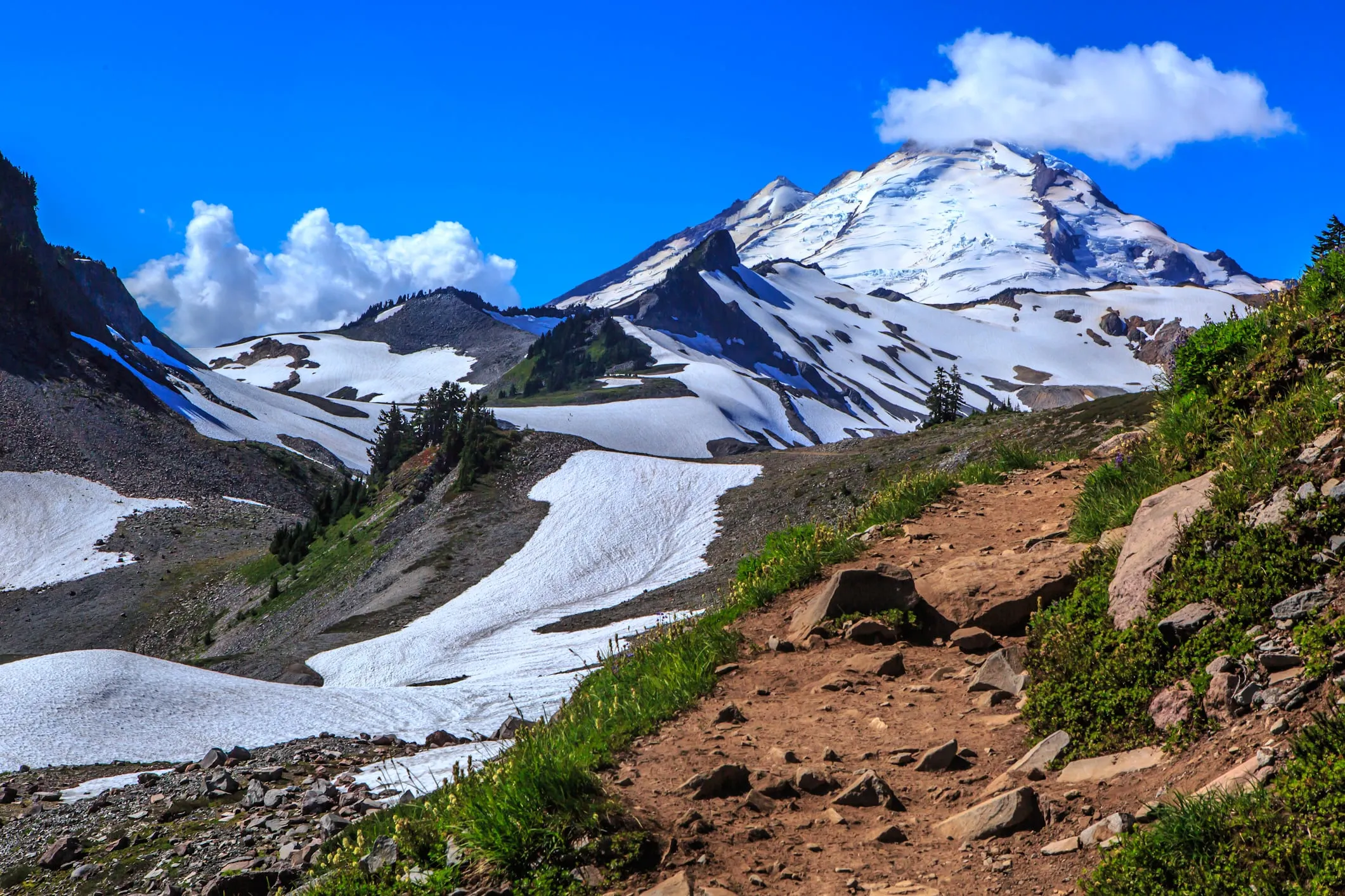 The Ptarmigan Ridge trail from Artist Point, walking toward Mount Baker. Nine miles of ridge and glacier separate this trail from the summit. Photo: Murray Foubister, CC BY-SA 2.0. Cropped and tonally adjusted.
.jpg)
Is any of this in North Cascades National Park?
Mostly no, and the difference shows up at the trailhead. The ski area, Heather Meadows, Artist Point and Mount Baker itself are all in Mt. Baker–Snoqualmie National Forest, in the Mt. Baker Ranger District. Mount Shuksan’s summit is over the boundary in North Cascades National Park. Practically, you need a recreation pass on the dashboard, not a park entrance fee.
The Forest Service honors a Northwest Forest Pass, an Interagency (America the Beautiful) pass or a digital pass at the Artist Point trailhead and the other Heather Meadows trailheads during the open season. Winter is a different permit again: parking on Glacier Creek Road in winter requires a Washington State Sno-Park permit. Two agencies, three passes, one mountain — worth sorting out before you are standing at a kiosk with no cell service, which up here is most of the time.
Is there a town called Mount Baker?
There is not. No town, no post office and no lodging carries the name, and there is none at the ski area either — the mountain has lifts, two day lodges and a parking lot, and that is all. The corridor’s beds are in Glacier, about 30 minutes below the lifts, and Maple Falls, about 45.
This is the practical cost of the naming mess. A search for “hotels in Mount Baker” returns places that can be an hour apart from each other, some of them not on the corridor at all, and at least one long-established local operator is no longer in business — we wrote up what happened to Mt. Baker Lodging after guests kept asking. Our Mt. Baker lodging guide lists what genuinely exists on the highway, and where to stay near Mt. Baker compares Glacier against Maple Falls on drive time and price.
Baker Lake is the same mountain, so why is it a different trip?
Same volcano, opposite side, and no road crosses between them. Baker Lake is a reservoir on the mountain’s south flank in Skagit County, reached from SR-20 near Concrete and then up Baker Lake Road. From Glacier that is roughly 95 miles of driving — back down SR-542 to I-5, south to Mount Vernon, east on SR-20, then up the lake road — because the mountain is in the way.
It is a real place and worth its own trip. It is not a side trip from a cabin on the Mt. Baker Highway, and guests who assume otherwise lose a day finding out.
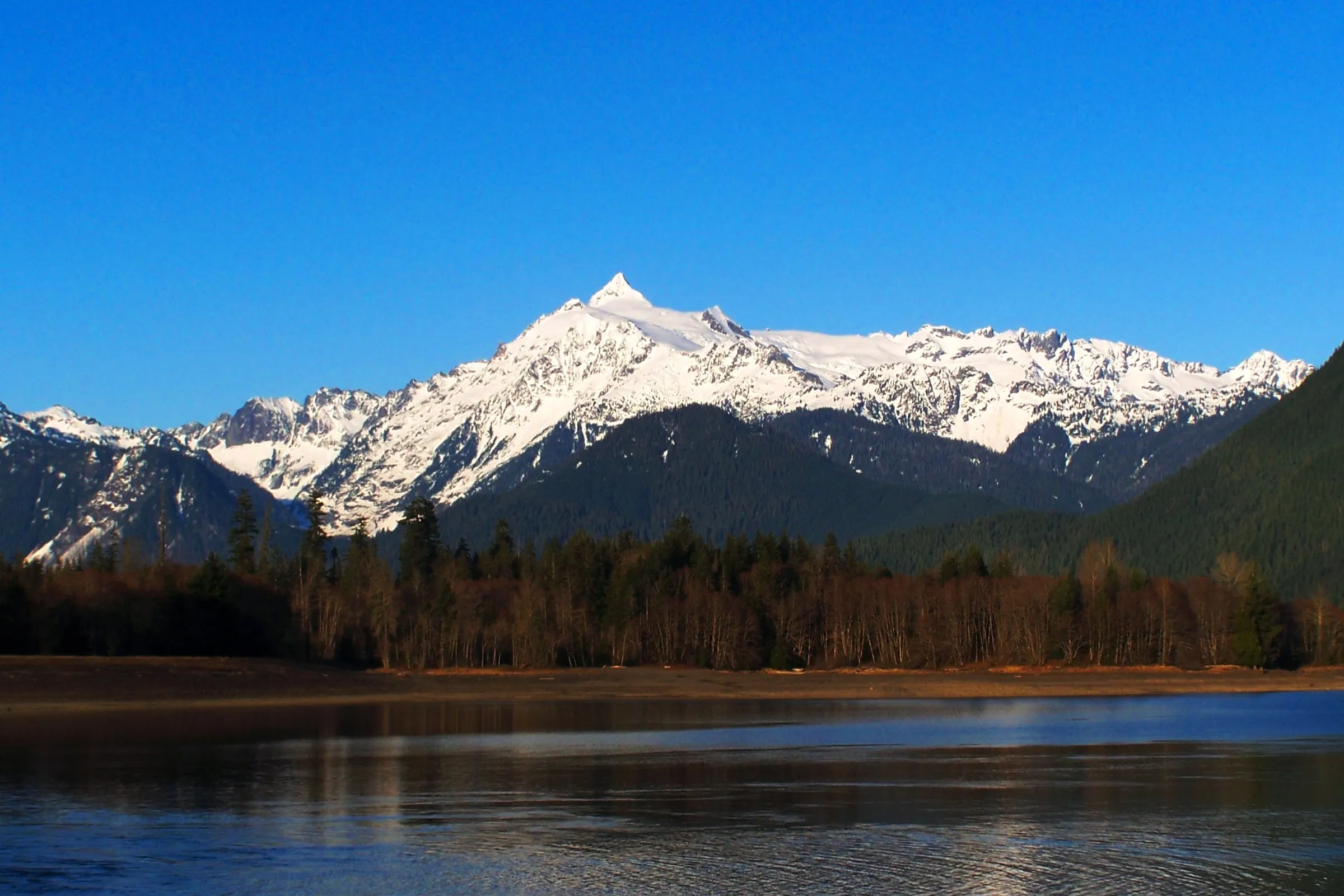 Baker Lake, on the volcano’s south side in Skagit County. The peak in the frame is Mount Shuksan again — even the lake named for Baker mostly shows you the other mountain. Photo: Lhb1239, CC BY-SA 3.0. Cropped and tonally adjusted.
What was the mountain called before it was Mount Baker?
Several things, in several languages, and the popular answer is probably wrong. George Vancouver named it in 1792 for his third lieutenant, Joseph Baker, who sighted it on April 30 that year. Two years earlier a Spanish expedition had mapped it as La Gran Montaña del Carmelo. Neither was the first name it had.
The name you see on brewery labels and trail signs is “Koma Kulshan,” and it does not hold up. Allan Richardson, who co-wrote the standard work on Nooksack place names, set this out in Whatcom Watch in 2019: speakers of four different Salishan languages had four different names for this mountain, and “Koma (or Komo) Kulshan is not a native name for Mt. Baker.” In Nooksack the peak itself is Kweq’ Smánit, “white mountain.” Kwelshán — the word anglicized into “Kulshan” — refers to the open slopes below, a shooting place where people hunted. Lummi and Halkomelem sources carry cognates of Kwelshán with their own readings.
So “Kulshan” is a real word from this valley that has been attached to the wrong part of the mountain, and “Koma Kulshan” is a construction. We use it on menus and beer taps up here anyway. It seemed worth knowing which parts of that are history and which are marketing.
Why does any of this matter when you are booking?
Because three of the mix-ups cost you a day. Booking near “Mount Baker” without checking which one, expecting the Picture Lake view from the ski area parking lot, and planning Baker Lake as an afternoon outing from Glacier are the three we see most, and all three are avoidable in about a minute.
What actually works: pick a base in Glacier or Maple Falls, drive SR-542 up for the day, and understand that the ski area, the viewpoint and the volcano are three separate destinations on one road. Mt. Baker Ski Area takes about 640 inches of snow in a normal winter and runs eight quad chairs with no beds at the top; Artist Point is summer and early fall only; the volcano is a climb.
Where to stay when you have worked out which Mt. Baker you meant
The Black Cedar is our three-bedroom A-frame in Glacier, sleeping six, about 40 minutes from the lifts and ten minutes from Glacier’s coffee and food. It has a cedar barrel sauna, a hot tub, an outdoor shower and an espresso bar, and it sits at the end of the corridor where the day trips actually start.
The Little Red Cabin is a renovated two-bedroom in Maple Falls sleeping four, 45 minutes from the ski area and 15 minutes below Glacier, with its own hot tub, a fire pit and the last gas station in the corridor down the road. Both are booked direct with us, at our best rate, direct from the owners. Neither is on Mount Baker, and neither is anything else up here.
Sources, all checked September 23, 2026: the USGS volcano profile for Mount Baker’s elevation and coordinates; Mt. Baker Ski Area’s mountain stats; the Forest Service on the Artist Point trailhead, Heliotrope Ridge and the Mt. Baker Wilderness; WSDOT on the Artist Point road; the Washington Trails Association on Heliotrope Ridge mileage; HistoryLink on the Seattle neighborhood; and Allan Richardson in Whatcom Watch on the Indigenous names. Distances between the summits and the ski area are our own arithmetic on published coordinates.