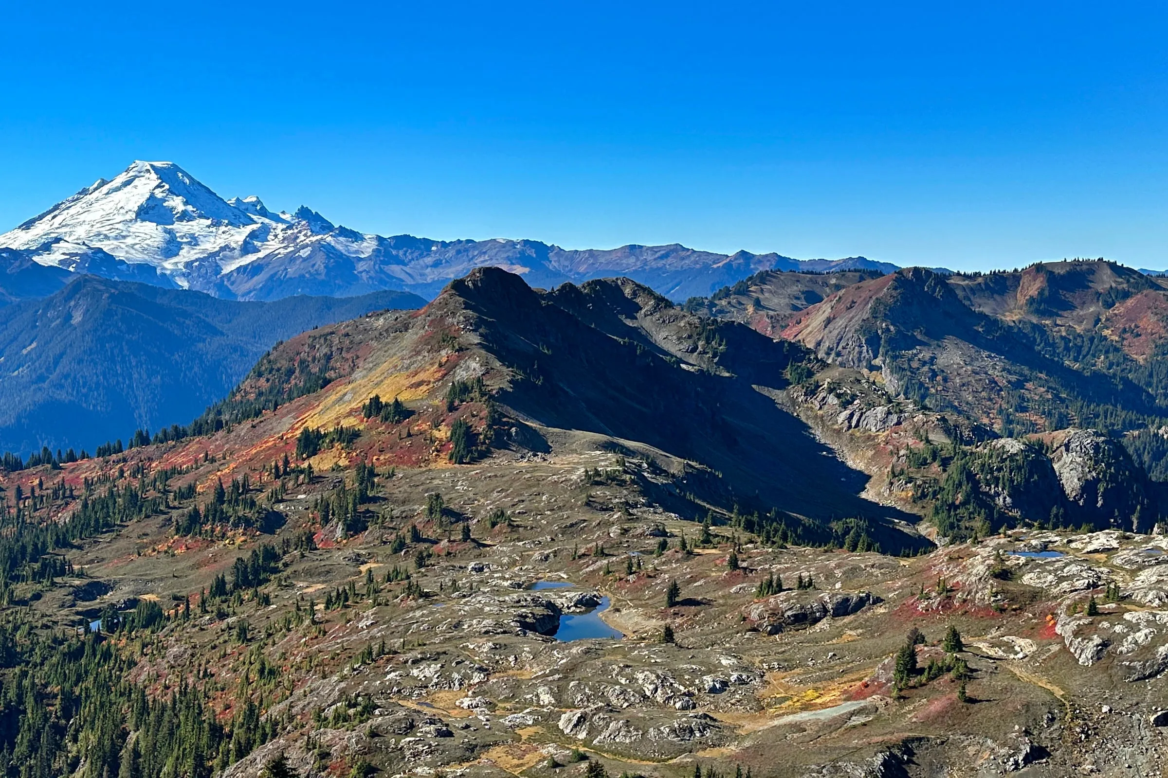
Yellow Aster Butte is 7.5 miles round trip and 2,550 feet of climbing to a 6,150-foot high point, at the end of 4.5 miles of gravel off the Mt. Baker Highway. It is the best fall-color hike in this corridor and it has no parking lot — just roadside space along the switchbacks. That last fact decides your whole day, so it belongs at the top rather than the bottom.
We send more guests up this trail in the first three weeks of October than any other month of the year, and the note we give them is always the same: leave earlier than feels reasonable, and buy the pass before you drive.
How long and how hard is Yellow Aster Butte?
Hard. WTA lists 7.5 miles round trip, 2,550 feet of gain and a 6,150-foot high point, and the first 1,500 feet of that arrive in under 1.5 miles. The Forest Service measures it slightly differently — about 4 miles one way and 2,500 feet to a false summit at 6,178 feet. Either way it is a full day.
| Round trip | 7.5 miles (WTA) |
| Elevation gain | 2,550 feet |
| High point | 6,150 ft (WTA) / 6,178 ft false summit (USFS) |
| Trail number | 686.1 |
| Trailhead | Twin Lakes Road (FR 3065), 4.5 miles of gravel |
| Facilities | Vault toilet. No potable water. |
| Pass | Northwest Forest Pass or America the Beautiful |
| Season | Summer–fall, snow-free only |
| Drive from The Black Cedar | about 45 minutes |
The shape of the walk matters more than the totals. You climb hard and immediately, sharing the tread with people headed to Tomyhoi Lake, switchbacking up through an avalanche path — which is precisely why this is a snow-free-season trail and not a spring one. At 1.5 miles the two routes split. Yellow Aster goes left and the grade finally eases, traversing the south flank for better than two miles with the volcano in front of you the whole way. At 3.6 miles an unsigned junction sends day hikers right to the summit and backpackers left, down steep switchbacks to the tarns.
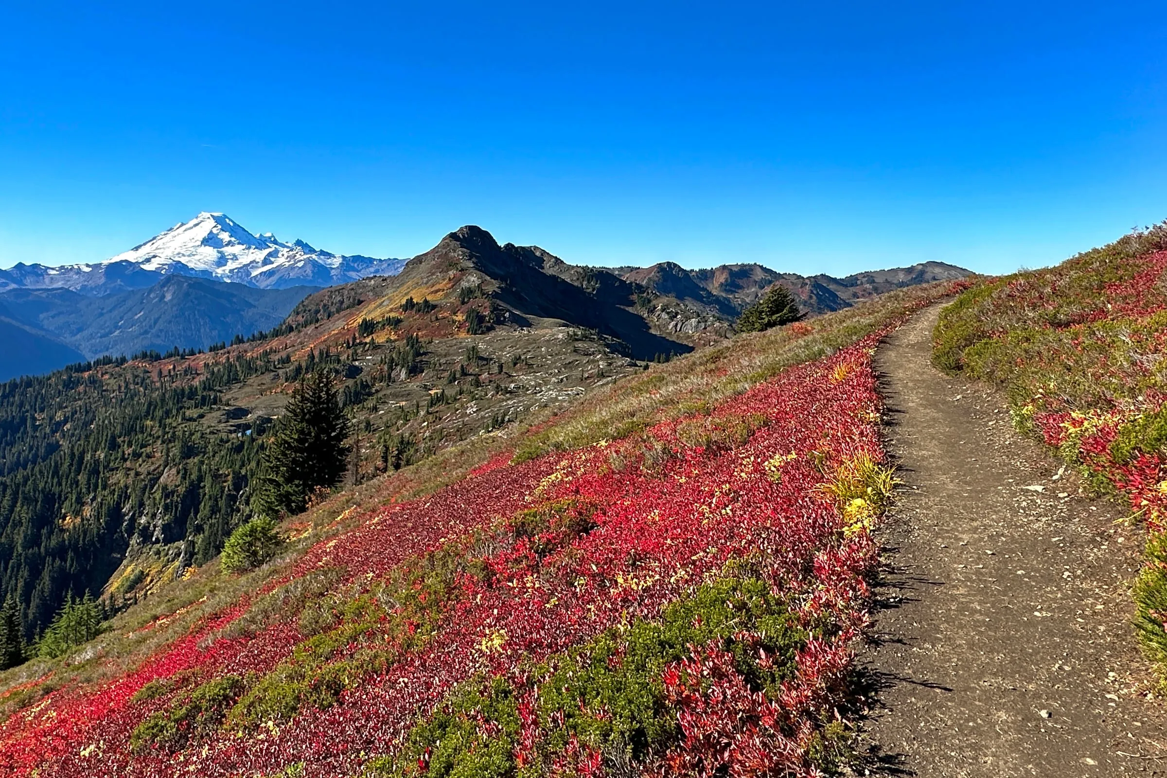 The traverse across the south flank, which is the part everyone remembers. Photo: Jeff Hollett, CC BY-SA 4.0. Cropped and tonally adjusted.

Where is the trailhead, and can a normal car get there?
Yes, to the trailhead. From Glacier, drive about 12 miles east on SR 542 and turn left on Twin Lakes Road (FR 3065) at the east end of the WSDOT Shuksan maintenance yard. The 4.5 gravel miles to the trailhead are fine for a passenger car driven patiently. The two miles above the trailhead are not.
The Forest Service is blunt about that upper stretch on its Twin Lakes Trailhead page: it is “narrow, with few pullouts, and is not maintained for passenger vehicles,” high clearance is wanted, four-wheel drive helps but is not required, and there can be mining truck traffic in summer. People conflate the two roads constantly and then wonder why the reviews disagree. Yellow Aster Butte and Twin Lakes are different destinations on the same road, and only one of them needs your car to be brave.
The turn itself is easy to miss and there is no reliable cell signal to re-route you — service on this highway thins out well before Glacier. Look for the maintenance yard, not for your phone. Our mile-by-mile guide to the Mt. Baker Highway has the landmark in context.
Why is parking the hardest part of this hike?
Because there isn’t a lot. The Forest Service describes the arrangement as roadside parking along the switchbacks — the road is the parking, above and below the trailhead, on a narrow gravel grade with limited turning room. On an October Saturday the cars run a long way down the hill and the last arrivals walk a bonus mile before the trail even starts.
There is no published capacity figure we could verify, so we won’t invent one. What we can tell you is the practical rule, and it is the same rule our guests report back on every autumn: be parked before 8am on a weekend in September or October, or go on a weekday. Both cabins are close enough that a genuinely early start is realistic rather than theoretical — this is most of the argument for staying up-valley rather than driving from Bellingham.
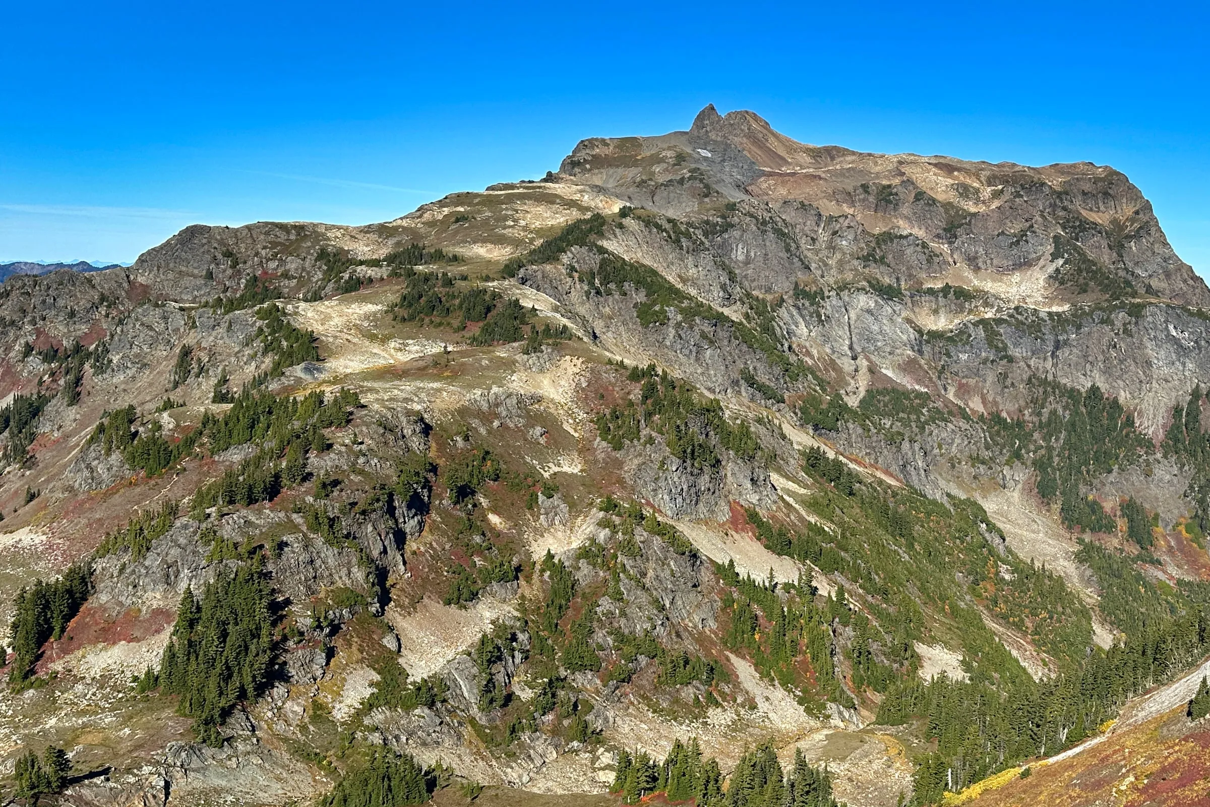 The butte itself. The summit is the notched block on the skyline; the trail works up the open slopes on the left. Photo: Jeff Hollett, CC BY-SA 4.0. Cropped and tonally adjusted.

What pass do you need at the trailhead?
A federal one. A Northwest Forest Pass at $5 per vehicle per day or $30 for the year, or an America the Beautiful interagency pass. A Washington Discover Pass is not valid here — the Forest Service says so explicitly, and it is the single most common mistake at this trailhead.
| Pass | Price | Notes |
|---|---|---|
| Northwest Forest Pass, day | $5 per vehicle | Covers this trailhead and most others on SR 542 |
| Northwest Forest Pass, annual | $30 | Same sites, all year, Washington and Oregon |
| America the Beautiful, annual | $80 US residents | Works everywhere the Forest Pass does |
| America the Beautiful, non-resident | $250 | The rate for visitors from outside the US |
| Washington Discover Pass | — | Not accepted at Forest Service fee sites |
The Forest Service also advertises Scan & Pay through the recreation.gov app at this trailhead. Treat that as a backup and not a plan: it needs a signal you probably won’t have. Buy online before you leave, or stop at the Glacier Public Service Center at milepost 34, which is open daily 8:00 am to 4:30 pm and keeps a self-service day-pass kiosk running outside the building around the clock.
When does the fall color peak, and are there larches?
No larches. The colour here is low huckleberry and heather turning red and orange across open slopes, generally strongest through late September and the first half of October, and it ends with the first heavy snow rather than on a date. For actual larch stands you have to drive Highway 20.
We make that correction constantly, because Pinterest has decided otherwise. The reason is geographic rather than seasonal: WTA’s own explainer on larches puts Washington’s larch species on the sunny eastern slopes of the Cascades, and Yellow Aster Butte sits west of the crest. No amount of good timing will put a golden tree in your frame here. What Yellow Aster gives you instead is a whole basin of it at once, at eye level, with a volcano behind — which photographs better than a stand of gold trees and is the reason this trail fills up in October. Our Mt. Baker fall color guide covers timing across the rest of the corridor.
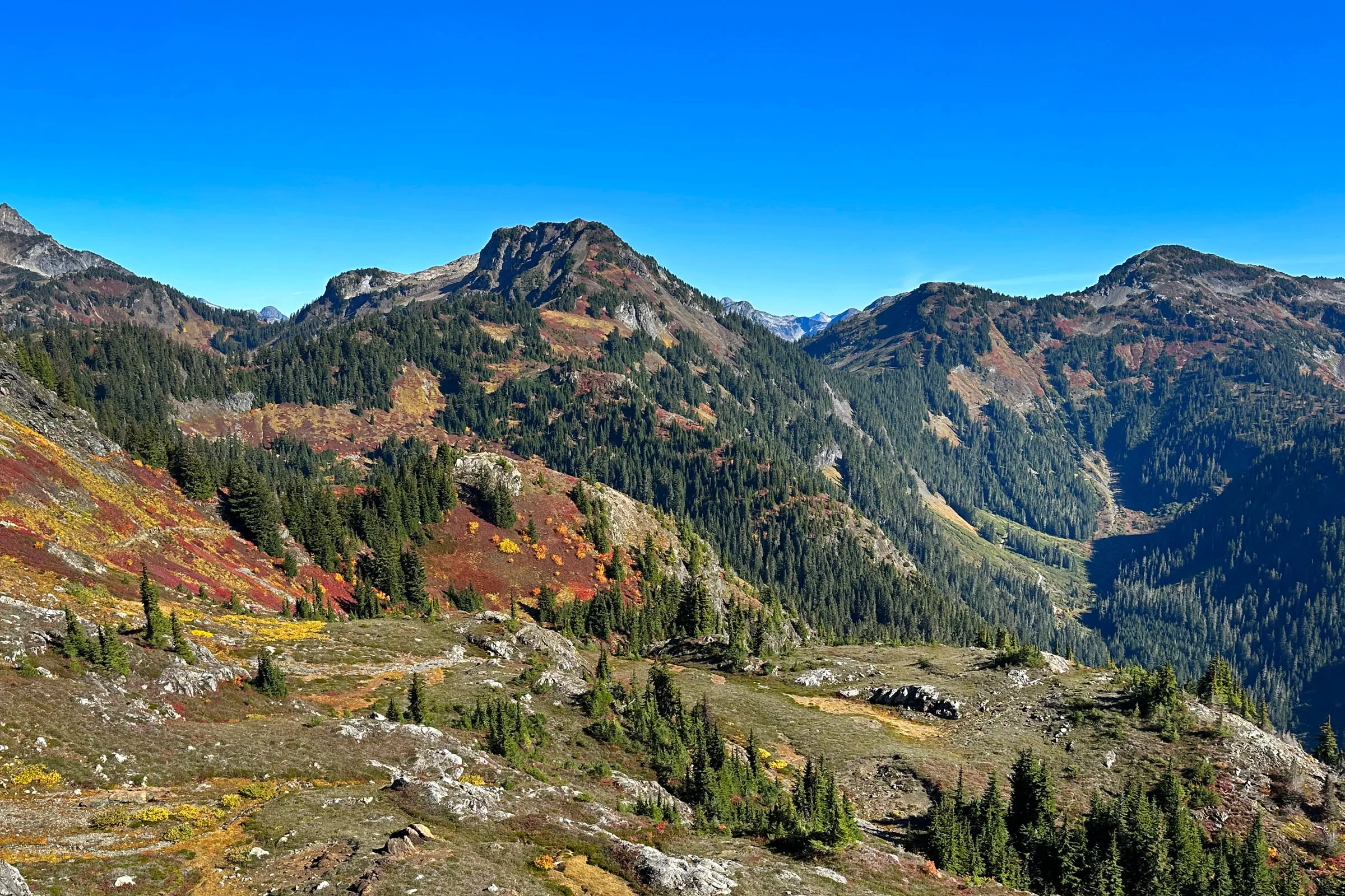 Red huckleberry and yellow heather on the open slopes, with the forested valley dropping away below. Photo: Jeff Hollett, CC BY-SA 4.0. Cropped and tonally adjusted.

What do you actually see from the top?
Mt. Baker to the south and Mt. Shuksan beside it, Tomyhoi Peak and the Border Peaks to the north, and the tarn basin directly below you. WTA lists the same set. It is one of the few summits in this corridor that gives you the volcano and the border wall of jagged peaks in a single turn, without a rope or a scramble.
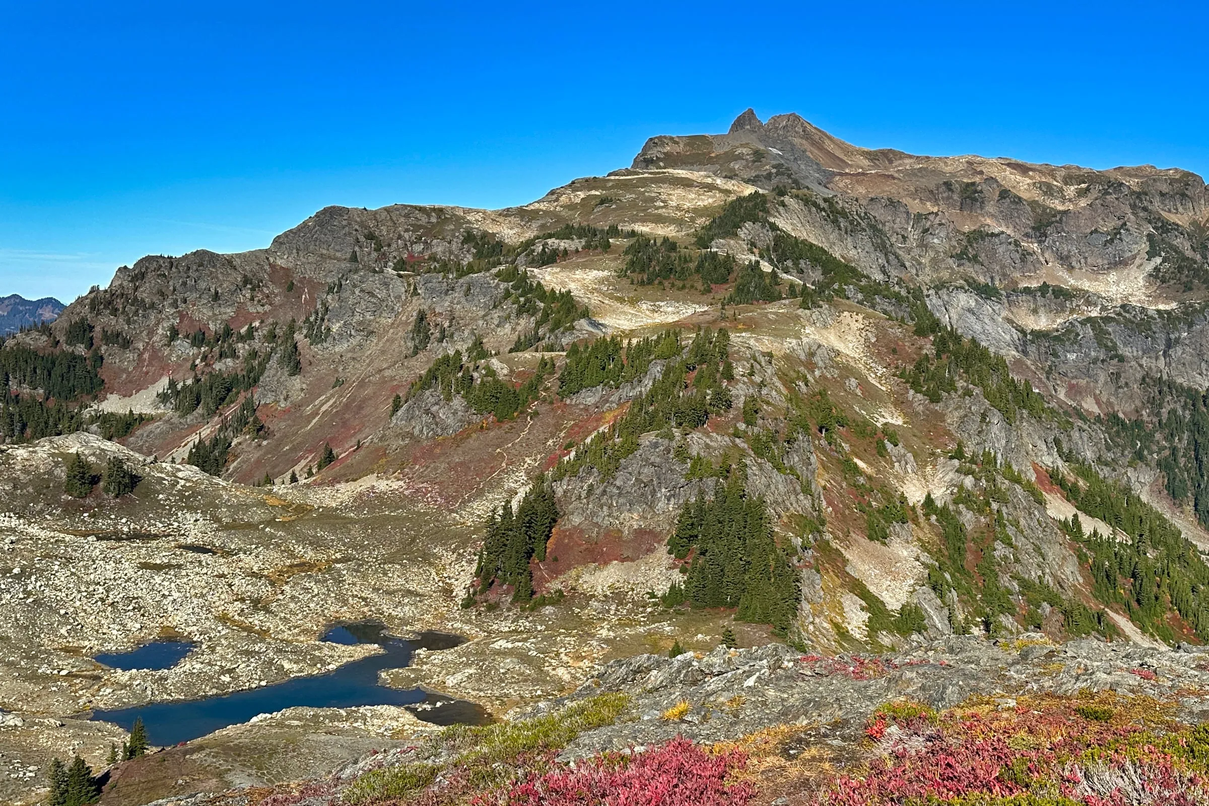 The last of the climb, seen from the bench above the tarns. The unsigned junction at 3.6 miles is where you choose between this and the descent to the water. Photo: Jeff Hollett, CC BY-SA 4.0. Cropped and tonally adjusted.

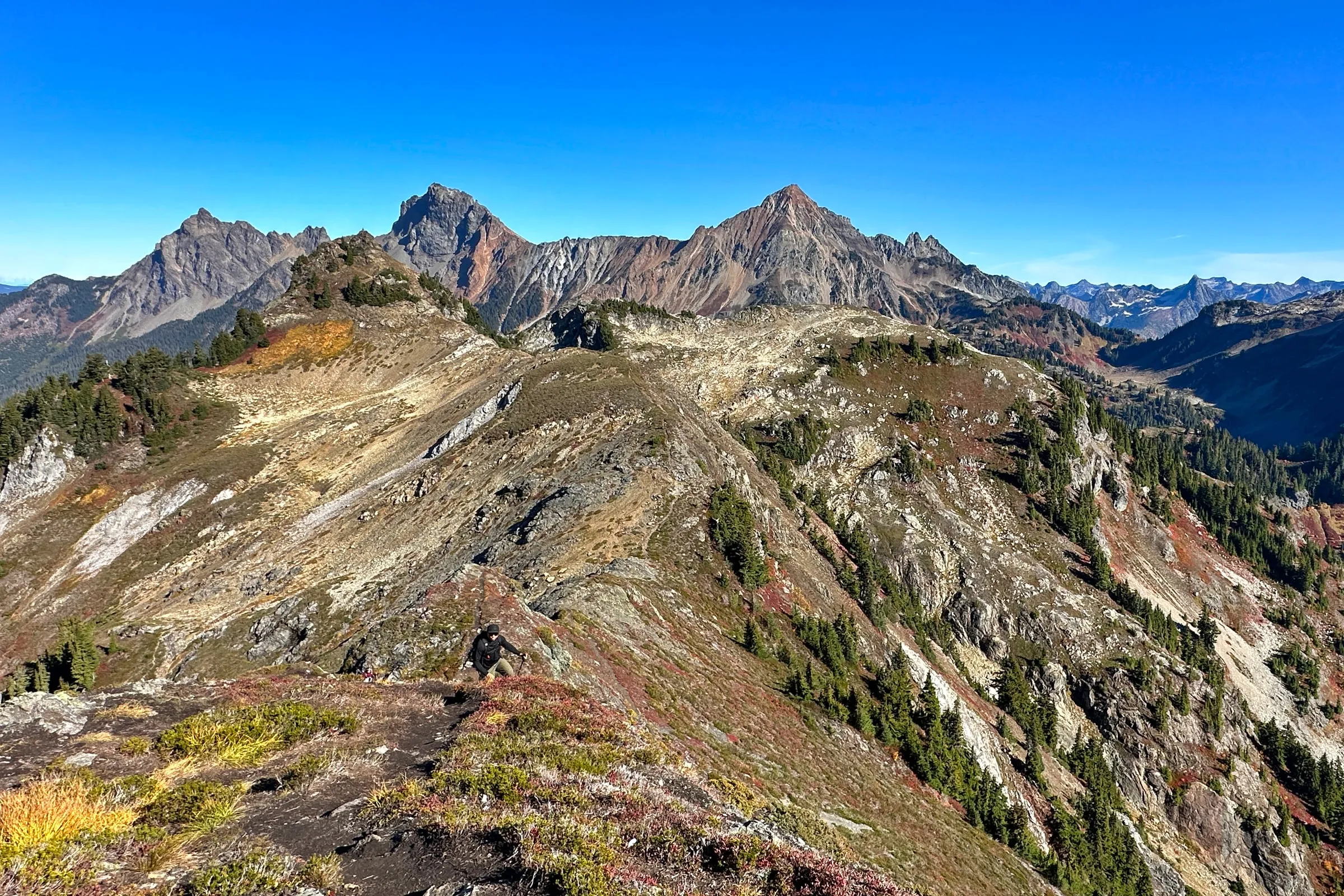 Looking north from the butte toward Tomyhoi Peak and the Border Peaks, with the Canadian ranges behind. Photo: Jeff Hollett, CC BY-SA 4.0. Cropped and tonally adjusted.

Can you camp at the tarns?
Yes, and essentially nowhere else. The Forest Service prohibits camping within one mile of the Yellow Aster Butte trail except at the tarns, roughly four miles in, and WTA’s guidance is to pitch only on snow, rock or bare ground so the meadows survive the traffic. Campfires are not allowed.
That last point is worth separating from the news. The forest-wide campfire ban that ran through this summer was rescinded on September 15, 2026 — but the prohibition on this trail is a standing wilderness rule, not a fire-season restriction, and it did not go away with the ban. Bring a stove.
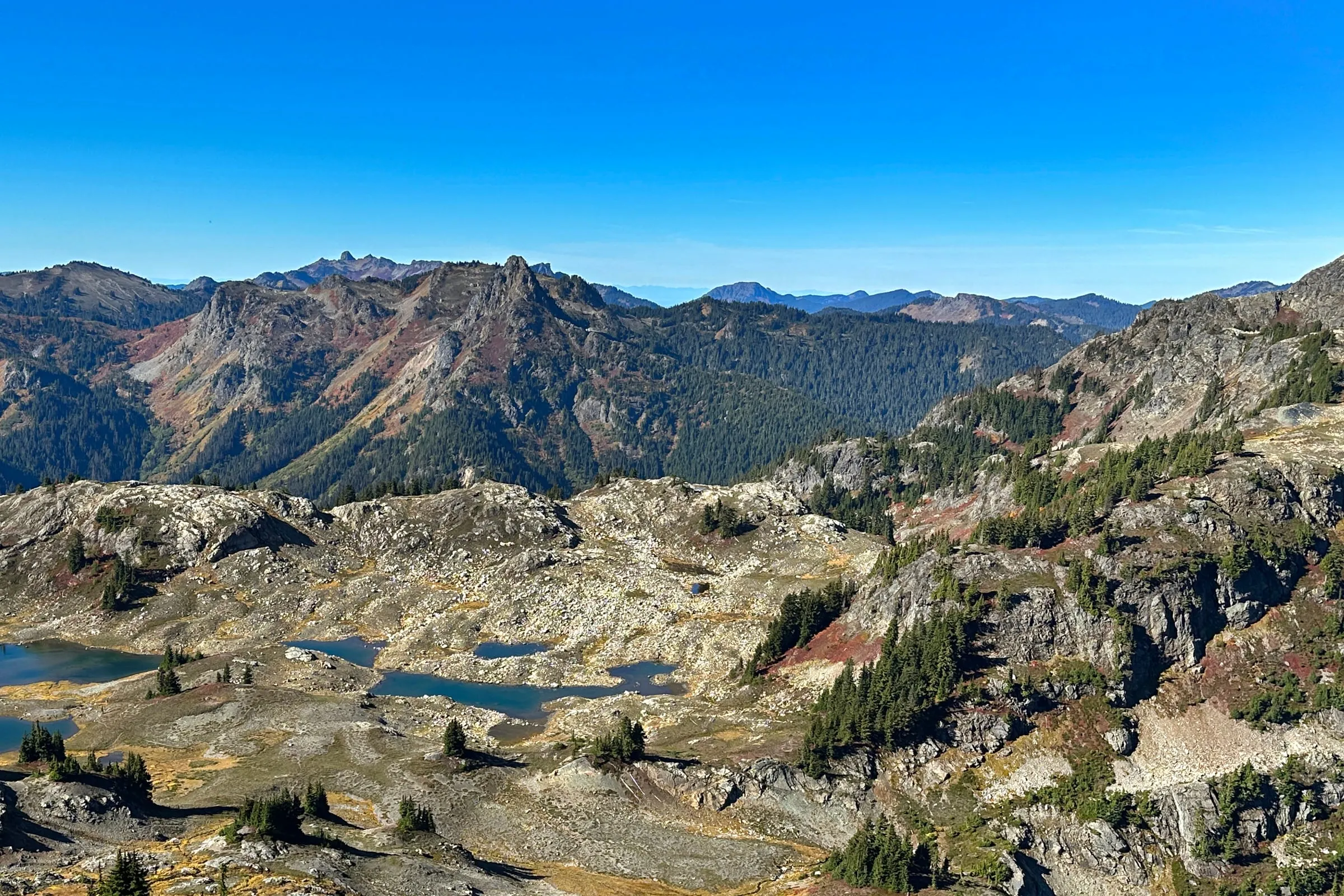 The tarn basin, about four miles in. This is the only legal camping on the trail, and the descent into it is steep enough to feel on the way out. Photo: Jeff Hollett, CC BY-SA 4.0. Cropped and tonally adjusted.

What are the rules people get wrong up here?
Four of them, and they are not generic Leave No Trace boilerplate — they are specific to this trail and the Forest Service posts them for a reason.
| Rule | The detail |
|---|---|
| Human waste | Pack it out. WTA’s listing for this trail says to pack out all human waste and not bury it. |
| Mountain goats | Stay 50 yards (150 feet) away. Keep pets leashed. |
| Camping | Only at the tarns, four miles in. No campfires. |
| Group size | 12 people maximum in wilderness, including pack animals. |
The goat rule is the one to take seriously, in both directions. The Forest Service posted an alert for this trail in July 2026 noting that injuries and even deaths have been caused by mountain goats, that a goat following you should be scared off by yelling and waving, and that sweaty gear left on a rock is a salt lick as far as a goat is concerned.
The other direction is the part that doesn’t make it onto hiking pages. Aerial surveys flown by the Lummi Nation put the Mount Baker Wilderness goat population at 345 animals in 2019 and roughly 63 in 2025, as reported by Columbia Insight, with a modelled range of 58 to 82. Their wildlife program manager attributes the decline to snowpack loss, disease, predators and human recreation together. If you see goats on this butte you are looking at a population that has lost most of itself in six years, and the 50-yard rule is doing more work than it appears to.
Is the highway open this week?
Right now, partly. WSDOT is running daily winter-preparation closures on the upper Mt. Baker Highway on Wednesday September 30, Thursday October 1, Monday October 5 and Tuesday October 6, 2026, roughly 7:30 am to 4:00 pm, for pavement and shoulder repairs and hazard-tree removal ahead of the seasonal closure.
The closed segment runs from Silver Fir Campground up to Picture Lake, which the Forest Service gives as milepost 48 to milepost 54 and WSDOT’s own advisory gives as milepost 47 to 54. Either way it is the stretch above the Twin Lakes Road turn, so Yellow Aster Butte sits below the gate and the ski-area end of the highway does not. If you were planning on Artist Point, Picture Lake, Chain Lakes or Ptarmigan Ridge on one of those days you need to be past Silver Fir by 7:30 am and you are staying up there until 4:00 pm.
The mileposts differ by one between the two agencies, so on a closure morning check the WSDOT SR 542 alerts and our road conditions page before you drive rather than trusting a number in an article. This is also the week the whole upper highway starts its slide toward winter: the Artist Point road closes with the first heavy snow, usually in October, and Yellow Aster closes itself at about the same time, since the avalanche path low on the trail makes it a poor choice once snow arrives.
Where should you stay for an early start?
Close. That is the entire point, on a hike whose difficulty is mostly a parking race.
The Black Cedar in Glacier is about 45 minutes from the trailhead — a black A-frame sleeping six, with a cedar barrel sauna and a hot tub, which is a better post-2,550-feet arrangement than most things you could drive home to. The Little Red Cabin in Maple Falls sleeps four and runs about 55 minutes out, with its own hot tub and fire pit. Both are no-pet properties, which is worth knowing before you plan a trail day around a dog. If you are weighing the two towns against each other, our where to stay near Mt. Baker guide lays out the tradeoff, and Mt. Baker lodging covers what else exists on this highway — which is not much, and that is the honest answer rather than a sales line.
If Yellow Aster turns out to be more than the group wants, our best hikes near Mt. Baker guide has shorter options off the same highway, several of which need no gravel road at all.
Last verified September 30, 2026. Mileage, gain, regulations and trailhead details from WTA and the Mt. Baker-Snoqualmie National Forest; road condition above the trailhead from the Twin Lakes Trailhead page; pass prices from the USFS Pacific Northwest region; the goat alert, fire-restriction rescission and highway closure dates from current forest alerts; goat population figures from Columbia Insight; Glacier Public Service Center hours from the Forest Service. We could not verify an official parking capacity for this trailhead and have not guessed at one. Prices, hours and road status change — the links above are the live versions.